



Ishigaki Island-Omotodake
Check it out and make a reservation early☆.
⬇︎Tuk-tuks and electric trikes are also rapidly gaining popularity☆


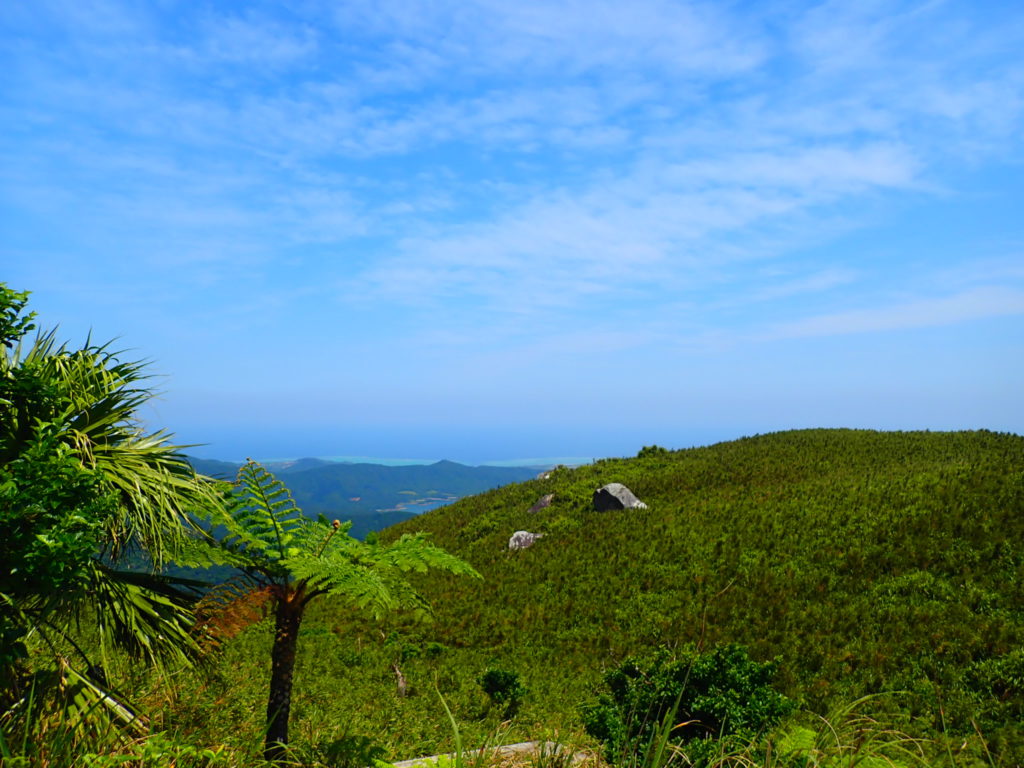
What is Omotodake (Omotodake)?
Omotodake is the highest mountain not only in the Yaeyama Islands including Ishigaki Island but also in all of Okinawa Prefecture.
However, its elevation is 525.5 meters, so it is not that high of a mountain when considered in Honshu and other areas.
In other Chinese characters, it is also written as "Omotodake," which is said to mean "the great main mountain of the island.
Directions to Omotodake
Omotodake is located about 20 minutes by car from Shin-Ishigaki Airport and about 30 minutes from Ishigaki Port Remote Island Terminal.
(1) Exit Shin-Ishigaki Airport and head north on Prefectural Route 87 or 209 for a while.
(2) You will see a sign for Maesato Dam, and if you follow the directions, you will see the entrance to Mt.
How to play at Mount Omotodake
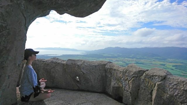
The most recommended activity at Omotodake is subtropical jungle trekking.
Since Mt. Omotodake is designated as a national park, there are almost no man-made structures, and it is truly an untouched jungle!
This makes it possible to see flora and fauna that can only be seen here.
Click here for more information on trekking Mt.
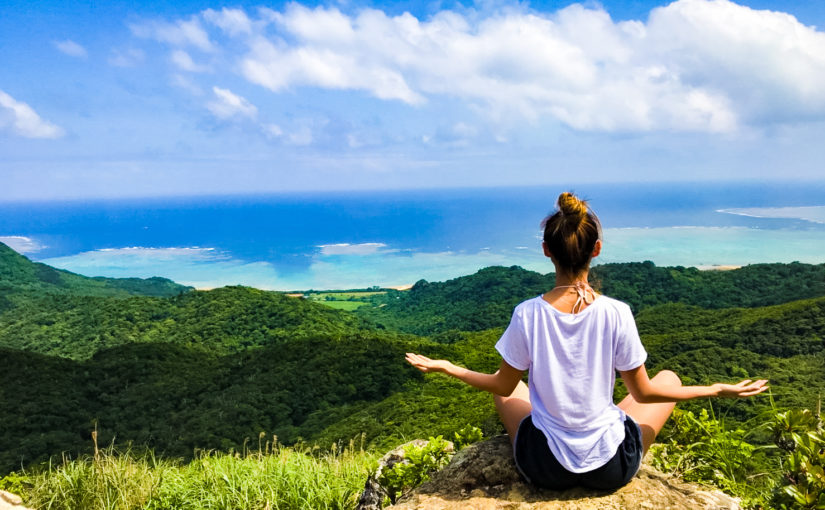
![[Okinawa, Ishigaki Island] Stunning 360-Degree Panoramic Views! An Easy Hiking Tour to “Nosoko Mape,” Selected as One of Japan’s Top 100 Island Mountains (No. 320)](https://ishigaki-tours.com/wp-content/uploads/2017/12/2018_04_22_55-825x510.jpg)
Canoeing & Mt. Nosoko trekking details are here↓↓.
![[Ishigaki Island] Choose Between SUP or Canoeing in the Fukidori River Mangroves & Trekking Tour to "Nozoko Marpe" for 360-Degree Panoramic Views](https://ishigaki-tours.com/wp-content/uploads/2023/10/S__141910030-825x510.jpg)
Mount Omotodake Details
Omotodake is the highest mountain in Okinawa Prefecture at 525.5 meters above sea level.
Of course, since it is the highest point in Ishigaki Island, you can see the whole island from the top of the mountain.
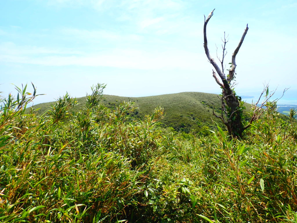
However, it is not so high in the country, and it is easy to participate, more like hiking than mountain climbing.
When trekking, you will encounter subtropical plants in primary colors and giant trees in the lush jungle.
Creatures found on Mt.
Ryukyu pigeon (Columba janthina)
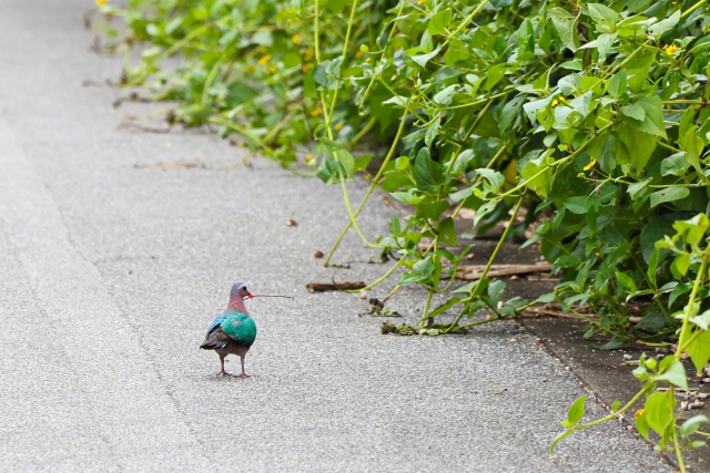
As its name suggests, the Ryukyu pigeon is a species of pigeon that inhabits the Ryukyu region, including Iriomote Island, Ishigaki Island, and Yonaguni Island.
They are found in dense evergreen broad-leaved forests of tropical type, and their bright body coloration is reflected in the lush green jungle.
crested serpent eagle (Spilornis cheela)
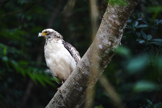
The crested serpent eagle is a bird species belonging to the eagle hawk family, a national natural treasure, which inhabits Ishigaki, Iriomote, and Yonaguni islands in Japan and Taiwan, China, Borneo, Sumatra, India, and the Himalayas overseas.
When its wings are spread, it can reach 55 cm in length and has a brown base body color with sparse small white spots.
Central Asian box turtle (Chelonia mydas agassizii)
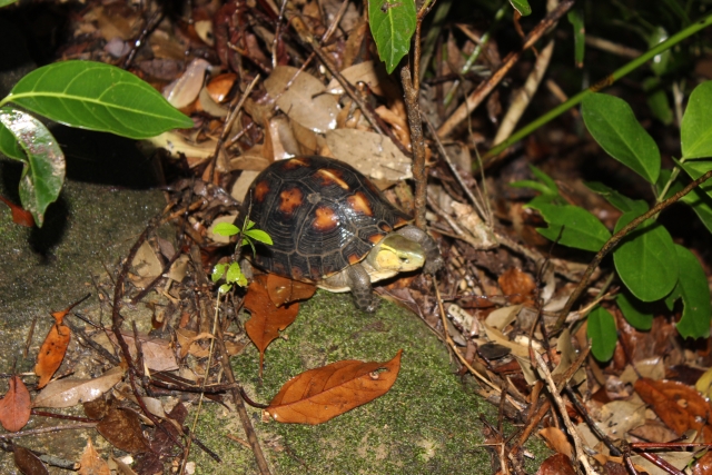
Semaru box turtles are designated national natural treasures belonging to the family Ichneumonidae, which are distributed in the mountains and forests of Asian wetlands such as Japan, Taiwan, and China.
The semaru box turtle has a rounded, dome-shaped carapace, and the abdominal side of the carapace can be opened and closed like a lid when the neck is tucked into the carapace.
Recommended sightseeing spots near Mt.
Arakawa Falls
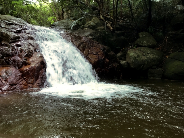
Arakawa Falls is the only waterfall on Ishigaki Island that flows upstream and downstream of Omotodake.
The downstream waterfall is smaller, with a drop of 3 or 4 meters, but the depth of the waterfall basin is also 3 or 4 meters, making it possible to dive in.
In addition, nearly 300 scarlet cherry trees grow wild in the surrounding area, brightening the jungle from February to March.
Location: Beikkai, Ishigaki City, Okinawa Prefecture
Access: 25 minutes by car from Shin-Ishigaki Airport, 30 minutes from Ishigaki Port Terminal
Parking: Available
Meals (nearby): Available
Toilet: None
![[Okinawa, Ishigaki Island] [Arakawa Falls] Head to Ishigaki Island’s Most Famous Mountain Stream! A Two-Stage Waterfall Climbing Tour Along the Arakawa River Through the Gorge](https://ishigaki-tours.com/wp-content/uploads/2018/02/P1004997-825x510.jpg)
Yaeyama palm colony in Yonehara
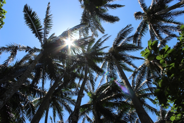
Yaeyama palm colony in Yonehara is a native area of Yaeyama palm trees located northeast of Mount Omotodake.
This Yaeyama palm colony in Yonehara is said to have the largest number of native Yaeyama palms of any spot in Japan.
In addition to the yaeyama palms, there are many other tropical plants growing wild in this cluster, so be sure to observe them.
Location: Beikkai, Ishigaki City, Okinawa Prefecture
Access: 25 minutes by car from Shin-Ishigaki Airport, 30 minutes from Ishigaki Port Terminal
Parking: Approx. 15 cars (free), paid parking available
Meals (nearby): Available
Toilet: Yes
Miyara River
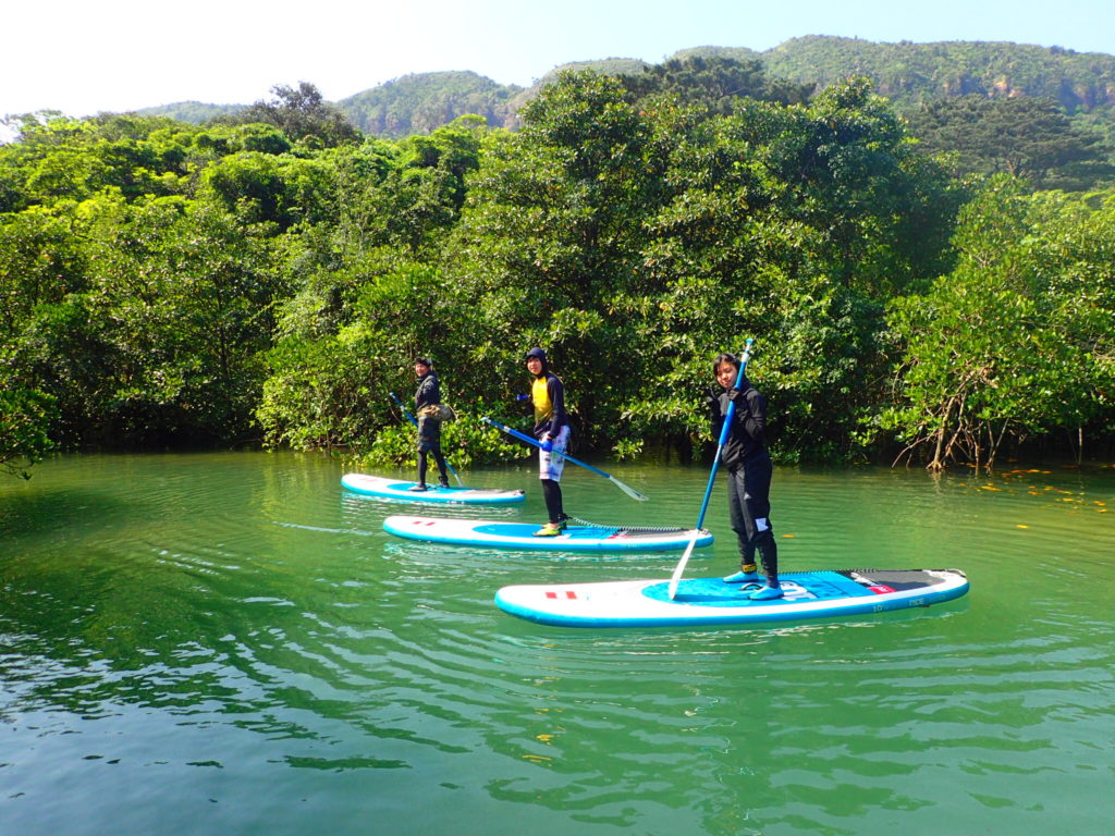
Miyara River is the largest river basin in Ishigaki Island, and mangroves grow along both banks of the river for 1.5 km from near the mouth to upstream.
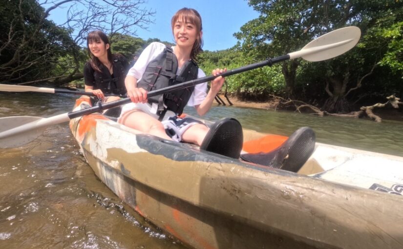
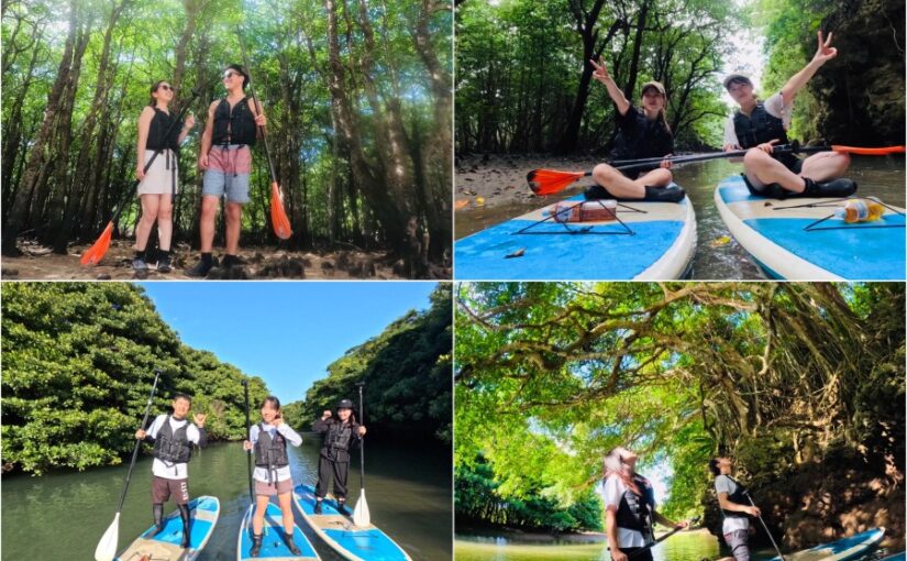
The Miyara River is a mangrove river that can be explored while cruising by SUP, canoe, or sightseeing boat.
In the jungle, you can see not only hirugi, but also subtropical flora and fauna, such as the Japanese jujube, kakatsugayu, Japanese cyprinid, Okinawa sharinbai, adan, and others!
Location: Ohama, Ishigaki City, Okinawa Prefecture
Access: 15 minutes by car from Shin-Ishigaki Airport, 15 minutes from Ishigaki Port Remote Island Terminal
Parking: Free parking: approx. 4 cars
Meals (nearby): None
Toilet: None
![[Ishigaki Island / Half-Day] Same-Day Reservations Accepted! Ishigaki Island’s Longest ☆ Nationally Designated Natural Monument “Miyara River” Mangrove Canoe Tour ★ Free Photos & Transportation Included](https://ishigaki-tours.com/wp-content/uploads/2024/01/IMG_0195-825x510.jpg)
Mount Omotodake Details
| Location | Tonoshiro, Ishigaki City, Okinawa, JapanView in MAP) |
| Access | 20 minutes drive from Shin-Ishigaki Airport, 30 minutes from Ishigaki Port Terminal |
| parking lot | ant |
| toilet | nashi (Pyrus pyrifolia, esp. var. culta) |
| Business Hours | - |
Click here for other Ishigaki Island trekking tours
See all activities
Ishigaki Island Tours
























































![[Ishigaki Island / Approx. 2.5 hours] Same-day reservations accepted! SUP tour to the mystical “Blue Cave”★ A new experience in crystal-clear waters♪ Free photos](https://ishigaki-tours.com/wp-content/uploads/2017/12/DB89F99F-C338-4E76-BC19-CEC4FDDE95AC-1-825x510.jpeg)