






Everything You Need to Know About Mount Omoto on Ishigaki Island! A Comprehensive Guide to the Charms of Okinawa’s Highest Peak, Including Hiking Routes, How to Get There, and the Spectacular Views from the Summit

A Complete Guide to Getting to Mount Omoto on Ishigaki Island and the Charms of Hiking There

In this column, we’ll cover how to get to Mount Omoto—the highest peak in Okinawa Prefecture, towering over Ishigaki Island—as well as parking information, hiking routes,The Spectacular View from the SummitHere is a summary of everything up to this point.
If you know how to get there and what to watch out for in advance, you’ll be able to enjoy your hike with peace of mind and without getting lost.
◆ For those interested in hiking trails on Okinawa Prefecture’s highest peak
◆ For those who want to use a rental car to get to the trailhead or parking lot
◆ For those who want to know what to watch out for before hiking, such as venomous snakes and rules against foraging

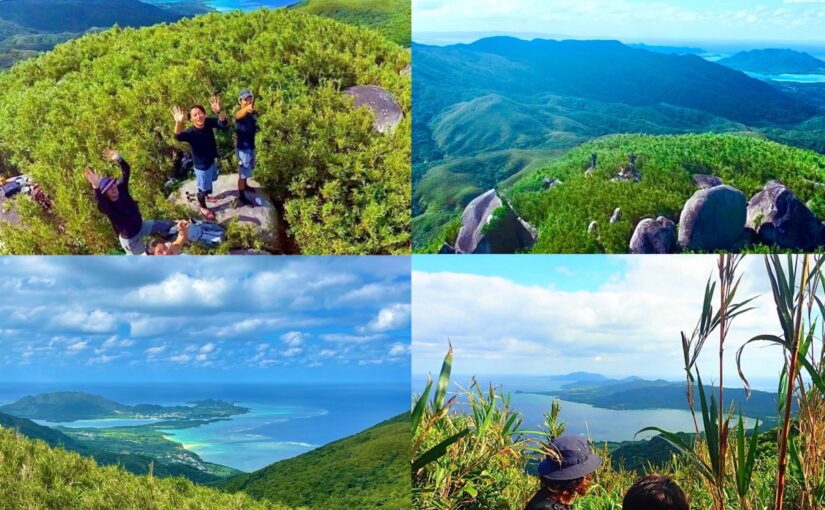
Check out Ishigaki Island trekking tours!
What Is Mount Omoto? Basic Information on Okinawa Prefecture’s Highest Peak

Mount Omoto rises in the center of Ishigaki Island and is the highest peak in all of Okinawa Prefecture.The Highest MountainIt is.
Also known as Ishigaki Fuji, it has long been cherished by the local community.
Here, let's take a closer look at the elevation, the origin of the name, and the religious beliefs associated with it.
Address: Tonoshiro, Ishigaki City, Okinawa Prefecture
Access: 20 minutes by car from Shin-Ishigaki Airport, 30 minutes from Ishigaki Port Remote Island Terminal
↓Yarabatake held! Click here for recommended tours
Elevation and Location
The elevation of Mount Omoto is526 metersIt is known as the highest mountain in Okinawa Prefecture.
It's located in the central part of Ishigaki City, Okinawa Prefecture, right in the heart of Ishigaki Island.
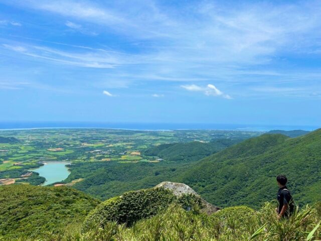
While it’s by no means a tall mountain compared to those on Honshu, its appeal lies in the fact that, since there are no tall mountains in the vicinity, you can see the entire island from the summit.
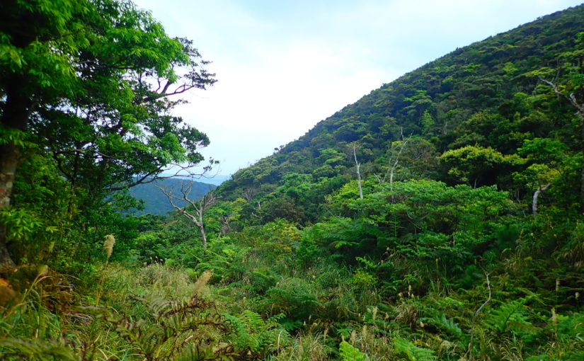
Geologically, it consists of granite, and its slopes are covered with subtropical evergreen broadleaf forests.
↓Nosoko-dake! Click here for trekking tours
The Origin of the Name "Mount Omoto"

In the local Yaeyama dialect, Mount Omoto is called “UmtudagiIt is called "the
"Umutu" means "source," and it is said to signify "the mountain that is the source of the island."
For this reason, it is sometimes written in kanji as “Ōmotodake,” and in the ancient text *Kyūyō*, it is also recorded as “Umotodake” and “Umotodake.”
As a symbol of Ishigaki Island, its name is even used for a local awamori brand.
The Deity of Mount Omoto and Religious Beliefs
Mount Omoto has long beenSacred MountainAs such, it has long been an object of worship for the islanders.
According to *The Chronicle of the Origins of the Ryukyu Kingdom*, the deity of Mount Omoto is said to be the second of three sisters.
At the Ontake shrine in the Nagura settlement, the Omoto deity “Umuteterashi” is enshrined, and prayers for rain have traditionally been offered toward this mountain.
When hiking, please be mindful that this is a sacred mountain cherished by the local community, and be sure to observe proper etiquette during your visit.
Directions to Omotodake

One of the key features of Mount Omoto is that it is easily accessible from both the airport and the port in the center of Ishigaki Island.
Here, we’ll explain how to get here from the Remote Islands Terminal, the airport, and public transportation.
↓Click here for rental car plans.


Directions from Ishigaki Port Remote Islands Terminal to the Trailhead

From the Ishigaki Port Remote Islands Terminal to the trailhead for Mt. Omoto, it's a drive ofApprox. 30 min.It is about as far as it goes.
Once you exit the terminal, head north on Prefectural Route 87 or Prefectural Route 209, following the signs for Maezato Dam.
When you see the sign, just follow the directions, and you'll arrive at the area around the trailhead for Mount Omoto.
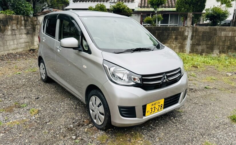
We recommend using a rental car or taxi, as they provide easy access.


Directions from Ishigaki Island Airport to the Trailhead

From New Ishigaki Airport to the trailhead for Mount Omoto, it's a drive ofApprox. 20 min.It is located at a relatively close distance.
Once you leave the airport, head north for a while on Prefectural Route 87 or 209.
Once you see the sign for Maezato Dam, follow the directions on it, and you’ll find the trailhead.
Since it's close to the airport, it's the perfect spot for anyone who wants to start hiking right after arriving.
Recommended Options with Airport Transfers
↓Click here for car rental plans↓



Click here for the ranking of car rentals that include Ishigaki Airport transfers
Access by Public Transportation

There are few bus routes in the area around Mount Omoto, so relying solely on public transportation to get there isn't very practical.
Since there are no bus routes that go directly to the trailhead,rent-a-carYou'll mainly be using taxis.
Since many people rent cars when sightseeing on Ishigaki Island, it’s convenient to rent one to use as a means of transportation for exploring the island in addition to hiking.
There are many car rental offices at both airports and seaports, so making a reservation in advance will make things go more smoothly on the day of your trip.
Information on the Omoto-dake Trailhead and Parking Lot
Before you start your hike, be sure to check the location of the trailhead and parking information.
Since some parts of the area can be confusing to navigate, it’s a good idea to familiarize yourself with the route beforehand.
There are some areas to watch out for, especially between the parking lot and the trailhead, so be sure to check those as well.
Location of the Trailhead
The trailhead for Mount Omoto is located along the road on the southeastern side of the mountain.
It read, “Omodake Mountain and Hiking Trail”SignThis serves as a landmark, so if you're driving there, look for it.
The surrounding area has a complex network of forest roads, so please proceed carefully so as not to miss the directional signs.
If it's your first time visiting, we recommend checking the signs as well, rather than relying solely on your GPS.
Availability and Number of Parking Spaces
There is no designated parking lot at Mount Omoto, so it is common to park in open spaces along the roadside where there are trail signs.
The number of parking spaces available isA few unitsSince there aren't that many, try to arrive early during busy times.
Since some areas are designated for street parking, please be considerate and make sure you don't block other cars from passing.
Although there is no charge, please be sure to take precautions against theft, such as not leaving valuables in your car.
The route from the parking lot to the trailhead

There may be a short distance between the parking area and the actual trailhead.
This section isUnpavedSince much of the route consists of forest roads, it’s safer to walk there rather than trying to drive through.
There are some areas where the ground is uneven, so be sure to wear comfortable shoes.
Including the walk to the trailhead, you'll have a chance to experience the unique natural beauty of Mount Omoto.
Mount Omoto Hiking Routes and Estimated Time to the Summit
Although the hiking trail on Mount Omoto is short, it offers a route where you can fully enjoy the unique subtropical natural scenery.
Here, we'll give you an overview of the route, the estimated time required, and the views from the summit.
I'll explain each step in detail so that even first-time climbers can follow along easily.
Overview of the Hiking Trail
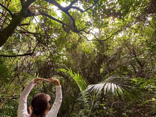
The round-trip distance from the trailhead to the summit is about 5 kilometers.
Along the way, the jungle-like atmosphere created by the evergreen broadleaf forests—featuring trees such as the Itajii—allows you to observe tropical plants up close.
A short distance from the trailhead lies what is said to be Ishigaki Island’s only waterfall,Arakawa Falls...will appear.
In winter, the Kanhi cherry blossoms around this waterfall reach their peak, so we recommend visiting during that time.


Time to the Summit and Difficulty Level
The total time required to reach the summit is approximately2 hoursIt takes about two and a half hours.
At 526 meters above sea level, it isn't a particularly high mountain, but some sections of the trail are surprisingly steep.
Since some sections are not well-maintained, those who are not used to hiking in the mountains should try to walk at a comfortable pace.
While it's something you can enjoy casually, the key is to stay focused and be well-prepared.
Scenic Viewpoints from the Summit

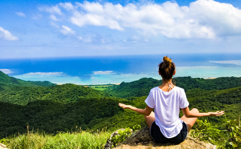
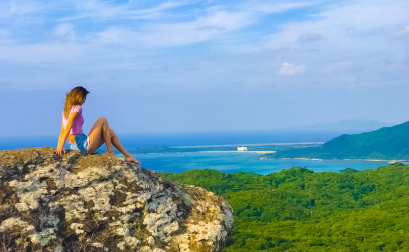
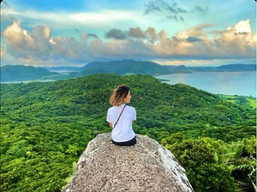
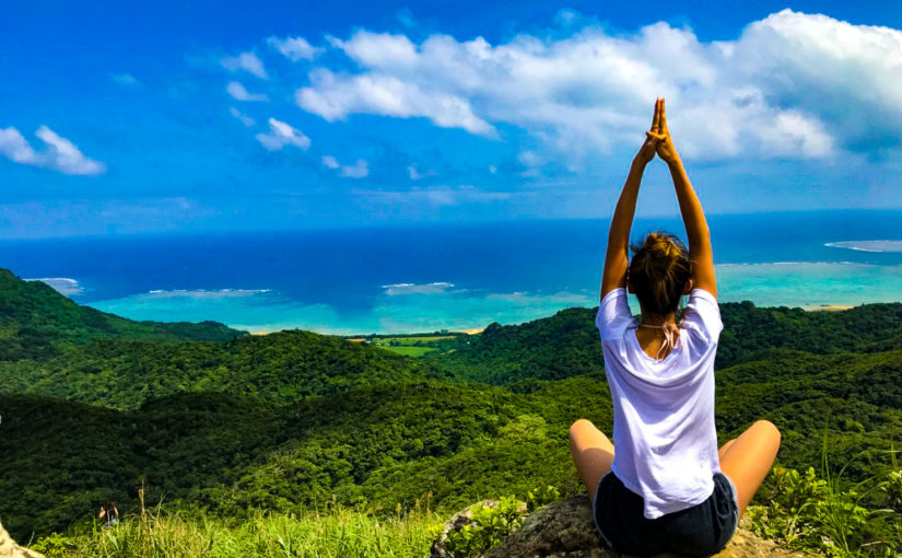
When you reach the summit, a vast panoramic view of Ishigaki Island unfolds before you.
Known for its beautyKabira BayAnother unique charm of Mount Omoto is the panoramic view it offers.
This scenery has actually been designated as a National Scenic Spot under the name “Kabira Bay and Mount Omoto.”
The view is so breathtaking that you’ll forget all about the fatigue from the hike, so be sure to bring your camera and give it a try.
Important Points to Know Before Hiking
Because Mount Omoto is a mountain rich in natural beauty, there are a few precautions you should be aware of before climbing it.
To ensure you enjoy your hike safely, be sure to check everything thoroughly in advance.
In this section, we'll explain how to deal with hubs, the rules for collecting items, and what to bring.
Precautions Regarding Hubs

Deep in the mountains of Mount Omoto, there is a venomous snake native to the Yaeyama Islands—Sakishima Habu...live there.
Since they may be hiding in thickets or among rocks, be sure to stay on the trail and avoid approaching the underbrush.
It is important to wear long sleeves and long pants to avoid exposing your skin, and to make sure your feet are well-protected with sturdy shoes.
If you happen to get bitten, please stay calm and seek medical attention right away.
Rules Prohibiting the Collection of Flora and Fauna
Mount Omoto is home to numerous rare plant and animal species that are at risk of extinction.
Special Natural Monumentcrested serpent eagle (Spilornis cheela)For example, the Asahina Spotted Skipper—a prefecturally designated natural monument—is a prime example.
Since collecting these rare species is prohibited by law, please limit yourself to taking photos and observing them.
Please follow the rules and enjoy your hike so that we can preserve this precious natural environment for future generations.
What to wear and bring

Mount Omoto differs between its base and summitTemperature differenceSince this can sometimes happen, we recommend wearing clothing that is easy to put on and take off when climbing.
Since the humidity is high—as is typical in subtropical climates—choosing breathable fabrics will help you stay comfortable.
Be sure to pack drinks for hydration, insect repellent, towels, and other essentials.
Wearing non-slip hiking boots will help you feel more confident while hiking.
Frequently Asked Questions (FAQ) About Climbing Mount Omoto
At an elevation of 526 meters, it isn’t particularly high, and since it takes about two hours round-trip to climb, it’s a mountain that even beginner hikers can easily tackle. However, since some sections aren’t well-maintained, be sure to wear comfortable walking shoes and appropriate clothing.
The truth is that there are few local bus routes in the area, making it difficult to get there using only public transportation. We recommend renting a car or taking a taxi from New Ishigaki Airport or the Ishigaki Port Remote Islands Terminal.
Since Sakishima vipers inhabit the mountains, please wear long sleeves and long pants to avoid exposing your skin. Also, collecting rare plants and animals is prohibited by law, so please limit yourself to observing and photographing them.
summary

In this article, we’ve covered everything from how to get to Mount Omoto—the highest peak in Okinawa Prefecture, located on Ishigaki Island—to parking information, hiking routes, and important precautions.
It’s easily accessible from both the airport and the port, and one of its appeals is how easy it is to climb—it takes about two hours round trip.
Be sure to familiarize yourself with key points—such as the trailhead and collection rules—before heading out, and then be sure to enjoy the spectacular view from the summit.
▼Click here for articles to read in conjunction with this article.