")
Boarding from Ishigaki Island! Introducing access and recommended spots for remote island ferry!
Table of Contents
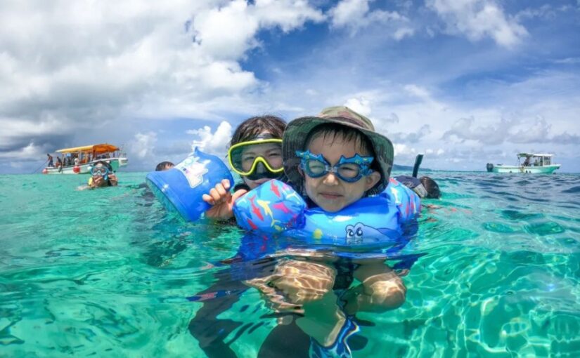
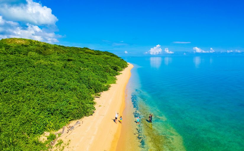
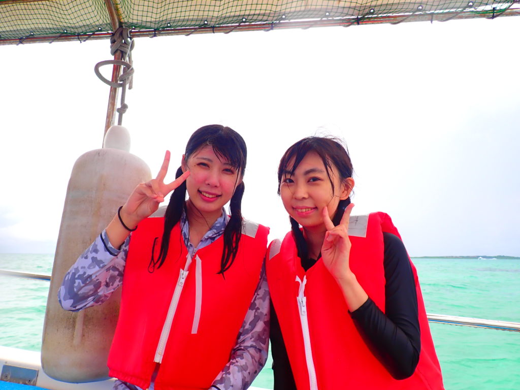
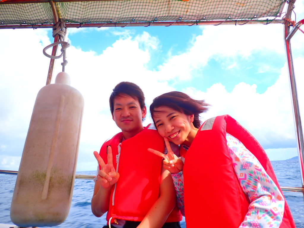
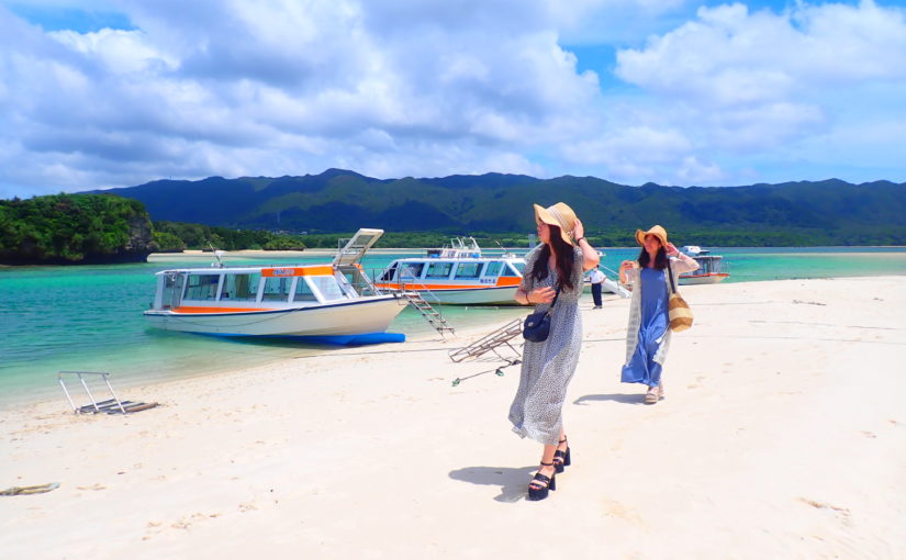
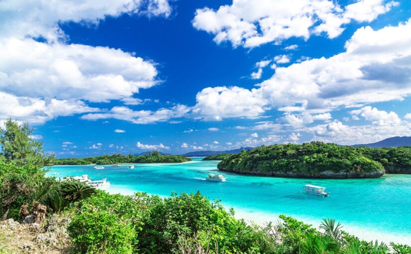
Yaeyama Islands (Okinawa)To,Ishigaki IslandmainlyTaketomiand ... andIriomote, ,Kohamaand other attractiveisolated islandThere are many islands in Yaeyama. For touring around such remote islands in Yaeyamaferryis indispensable. There are various ways to access the islands, from islands with regular flights from Ishigaki Port Terminal to islands that can only be visited by taking an activity tour. In this page, we introduce the islands accessible from Ishigaki Island and ferry information (timetable and fare information).
Taketomi
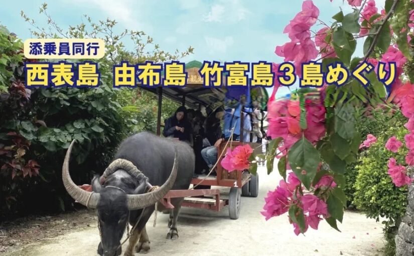
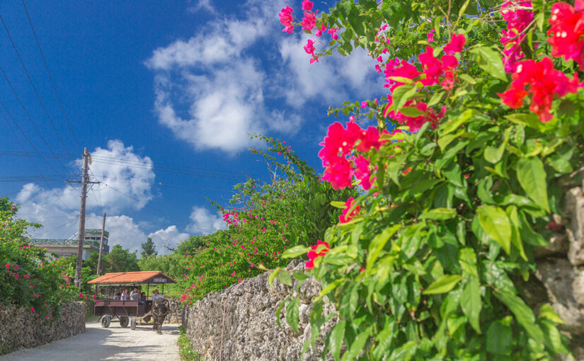
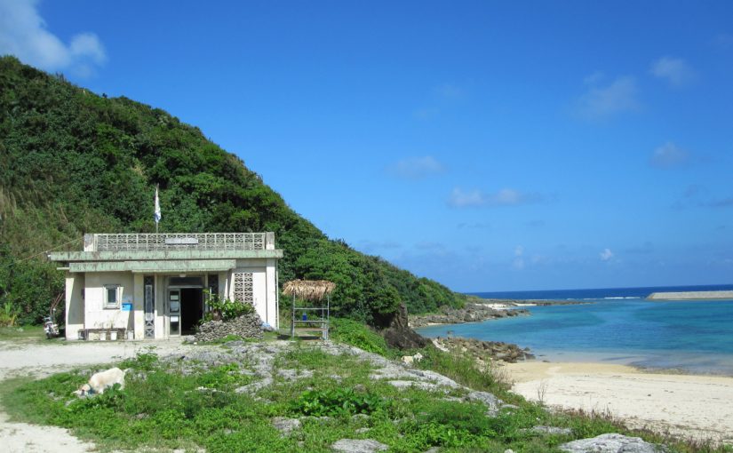
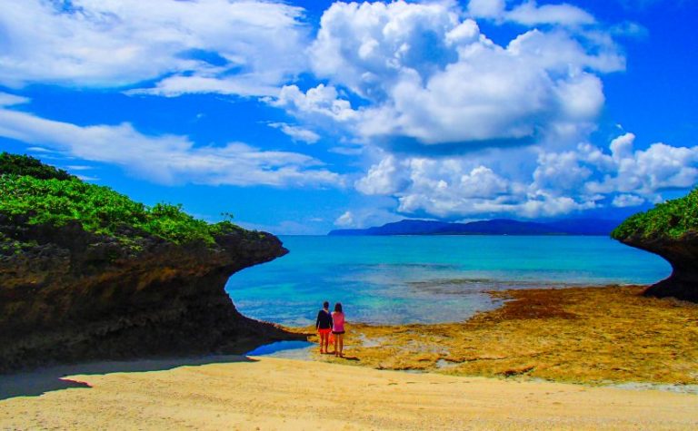
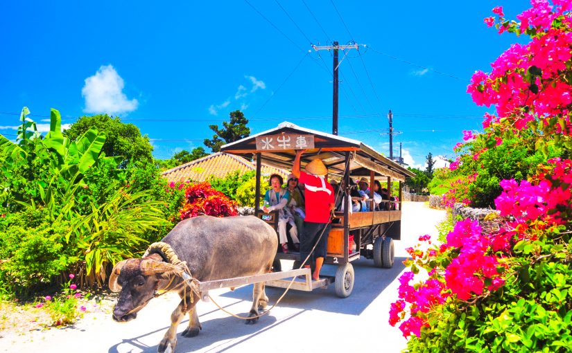
Taketomi Island is the nearest remote island from Ishigaki Island, located about 10 minutes by boat from Ishigaki Port. It is a small island with a circumference of 9 km, but there are many sightseeing spots such as Kondoi Beach and West Pier. You can take a buffalo cart to explore the villages that still retain the original landscape of Okinawa, such as red-tiled Okinawan houses and Ishigaki Island Sasa, which is designated as an Important Preservation District for Groups of Traditional Buildings.
Click here for popular island tours
Related columns are here↓.
Access from Ishigaki Island to Taketomi Island
As mentioned above, Taketomi Island is located near Ishigaki Island and can be reached in 10 minutes by boat. Therefore, there are many flights and the island is crowded with tourists. The fare and timetable of Taketomi Island ferry are as follows.
5 Sightseeing Spots on Taketomi Island
Sightseeing Spots on Taketomi Island (1) West Pier
The West Pier is one of the most beautiful spots on Taketomi Island, from which you can see the beautiful sunset. The pier stretches about 105 meters toward the sea, from which you can look into the surrounding sea and watch the sunset or star gazing. During daytime high tide, colorful fish swim around in the crystal clear water.
It was built in 1938 for people who were going to Iriomote Island to work on rice cultivation, as Taketomi Island is not suitable for rice cultivation, and was used until 1971. In 2005, it was designated as a Tangible Cultural Property of Japan.
Location: Taketomi Island, Taketomi Town, Yaeyama County, Okinawa Prefecture
Access: 15 minutes by bicycle from Taketomi Port
Parking: None
Meals (nearby): None
Toilet: None
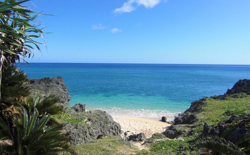
Sightseeing Spots on Taketomi Island (2) Kondoi Beach
Kondoi Beach is one of the most popular beaches on the island, located 25 minutes on foot from Taketomi Port, and is one of the best spots in Yaeyama, ranked 6th in TripAdvisor's Best Beaches in Japan by travel lovers in 2017. The contrast between the white sand beach and the clear ocean is very beautiful, and the shallow water makes it a suitable beach for family swimming. Basically, it is suitable for swimming rather than snorkeling because of the sandy seabed to the offshore area.
Location: Taketomi, Taketomi Town, Yaeyama County, Okinawa Prefecture
Access: 25 minutes on foot from Taketomi Port
Parking: Available
Meals (nearby): Available
Toilet: Yes
Sightseeing Spots on Taketomi Island (3) Star Sand Beach
Star Sand Beach is the second most famous beach after Kondoi Beach, and it is a place where there is a lot of sand shaped like stars. This star-shaped sand is the shell of a foraminifer called baculodipsina. It is said that holding star sand brings good luck, so it is a good idea to look for it and take it home with you. Try pressing your palm against the sand and then looking at your hand, as it is easier to find it. There is a store near the entrance to the star sand beach, so you can relax and have a good time without having to worry about water supply or snacks.
Location: Taketomi Island, Taketomi Town, Yaeyama County, Okinawa Prefecture
Access: 30 minutes on foot from Taketomi Port. 10 minutes by bus from Taketomi Port.
Parking: Available
Meals (nearby): None (stores available)
Toilet: Yes
Sightseeing Spots on Taketomi Island (4) Taketomi Folk Art Museum
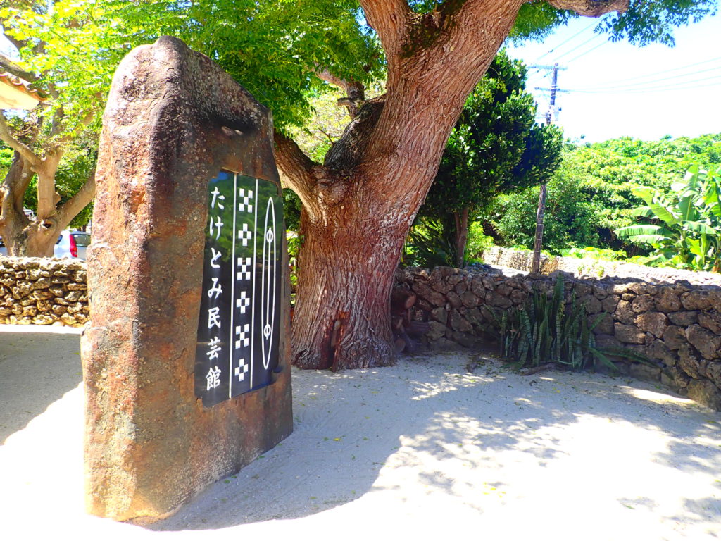
Taketomi Folk Art Museum is a folk art museum where you can observe the traditional weaving of Taketomi Island, such as mincer weaving and basho weaving. You can actually experience weaving and souvenirs are also available. There are panels and demonstrations of traditional textiles of Taketomi Island, and you can experience to know about the culture. At the weaving experience, you can make a coaster of about 10 cm in length and width in less than an hour. You can also make a mincer woven tablecloth. Even small children can make a weaving cloth with the help of a detailed lecture.
Location: Taketomi Island, Taketomi Town, Yaeyama County, Okinawa Prefecture
Access: 10 minutes from Taketomi Port by other means, 10 minutes by rented bicycle
Parking: None
Meals (nearby): Available
Toilet: Yes
Sightseeing Spots on Taketomi Island (5) Kohon Gogu
Taketomi Island has 28 Utaki, 6 of which are called Muyama, the most important Utaki. Kohon Utaki belongs to Muyama, and there are 6 villages around these 6 Utaki, and each Utaki enshrines a deity. Kohon Utaki is located on the south side of the village and is the last point of sightseeing in the village. There are other Utaki nearby, so please visit them as well.
Location: Taketomi, Taketomi Town, Yaeyama County, Okinawa Prefecture
Access: 8 minutes by car from Taketomi Port
Parking: None
Meals (nearby): None
Toilet: None
Kurushima
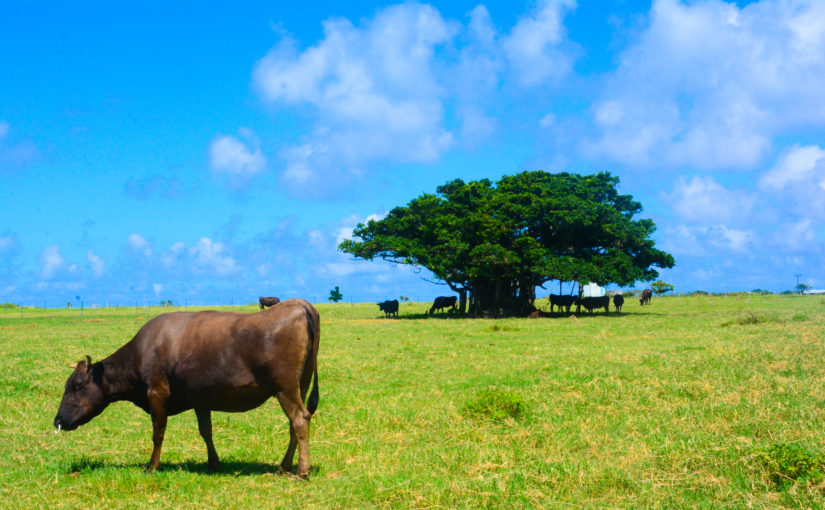
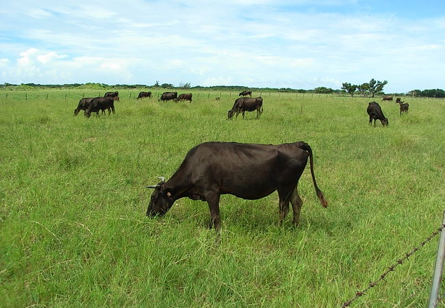
Kuroshima is a remote island nicknamed "Heart Island" because of its heart shape, located in the western part of Iriomote Island. On Kuroshima Island, there are about 3,000 head of cattle grazing pasture for a population of about 200, which is more than 10 times the population. The cows are raised in a stress-free environment and taste very delicious.
Kuroshima, such an island of cows, holds an annual cow festival. At the festival, beef dishes are served, and events and entertainment are held. The first prize of the lottery is a head of beef! The Cow Festival is open to non-island residents as well, so feel free to participate and win a cow! Kuroshima is a small island and can be circled on foot in about 2.5 hours. If you have a rented bicycle, you can tour around the island quickly and easily. You can also rent a guest house near the port, so please be sure to include accommodation in your visit.
Access to Kuroshima from Ishigaki Island
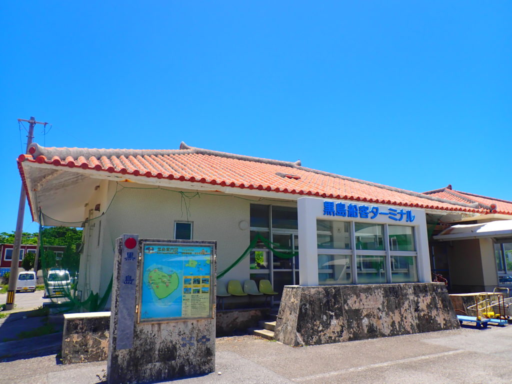
There are only five regular boats a day from Ishigaki Island to Kuroshima, so be sure to check the timetable and visit early. However, the last departure from Kuroshima is at 17:35, so if you want to enjoy the night view of Kuroshima, it is recommended to make a reservation for accommodation. The ferry schedule and fare from Ishigaki Island to Kuroshima is as follows.
Click here to play in Kuroshima
5 Sightseeing Spots on Kuroshima
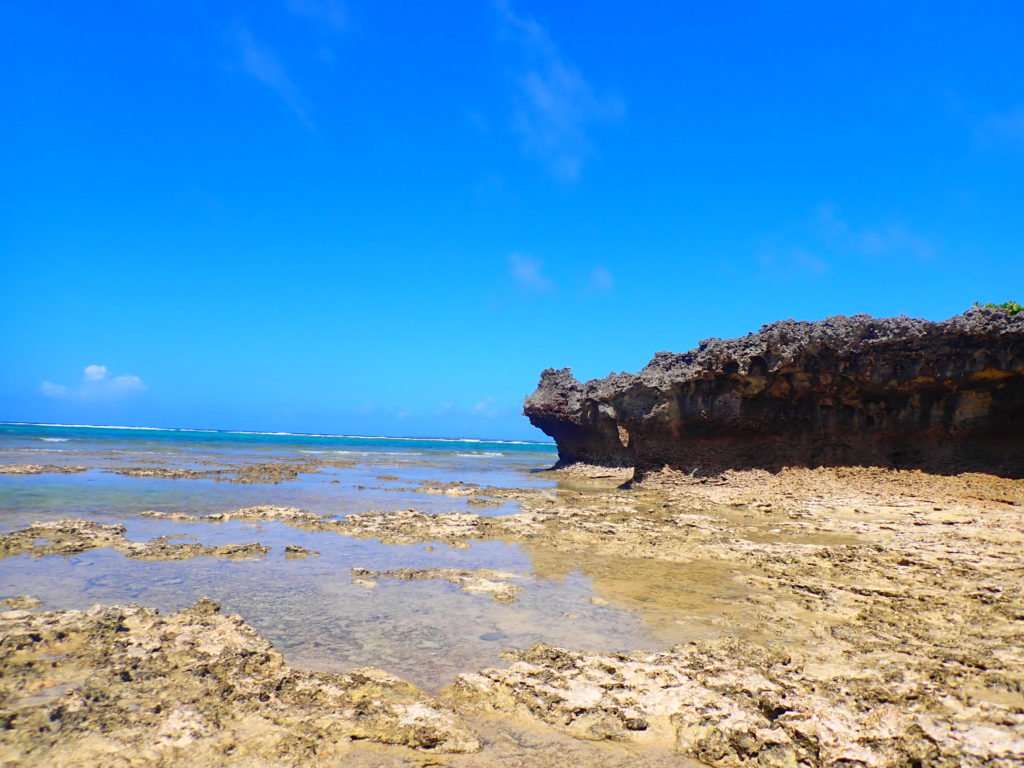
Sightseeing Spots on Kuroshima Island (1) Nishi no Hama
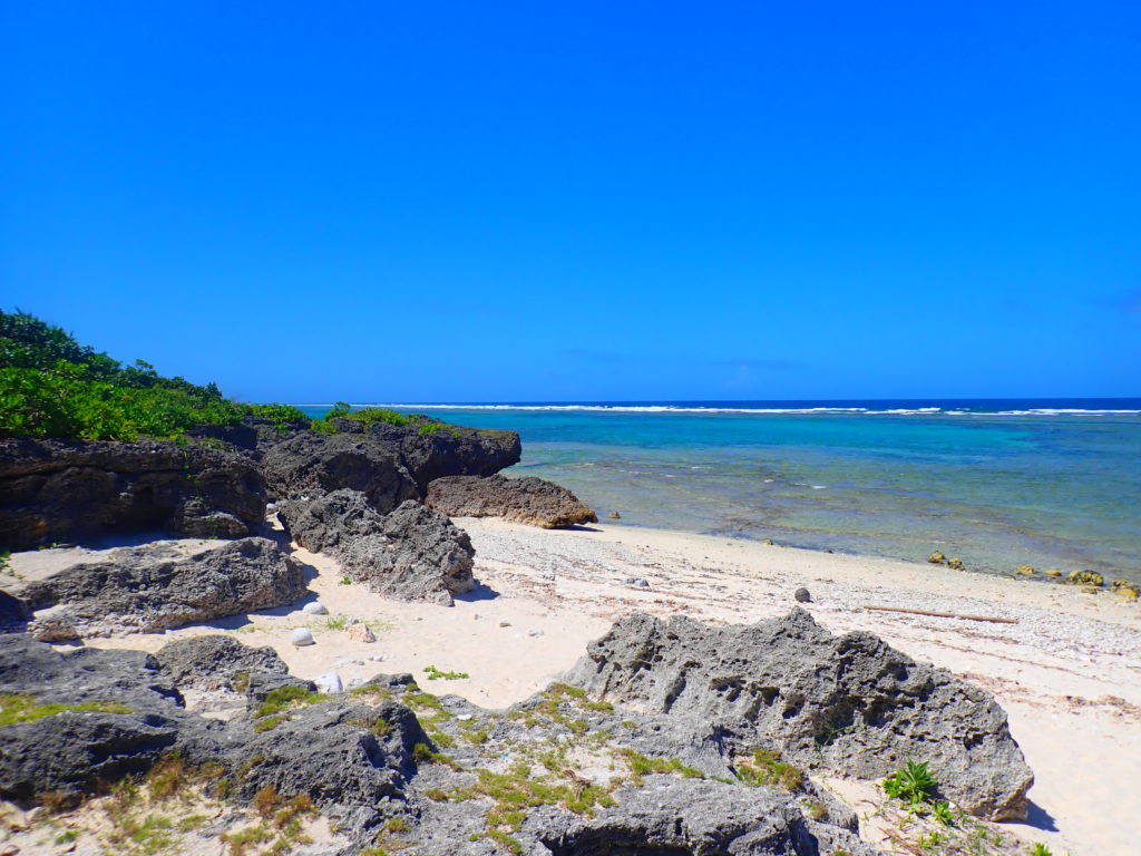
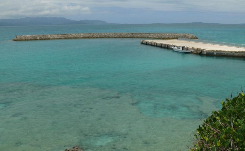
Nishi-no-hama is accessible by a 3-minute walk from Kuroshima Port, and is a long natural beach with crystal clear waters and a 2-km stretch of white sand. The beach is designated as a no-swimming beach due to the fast currents, so there are few tourists and you can enjoy the beautiful scenery all to yourself.
Location: Kuroshima, Taketomi Town, Yaeyama County, Okinawa Prefecture
Access: 3 minutes on foot from Kuroshima Port
Parking: None
Meals (nearby): None
Toilet: None
Kuroshima Tourist Attractions (2) Prefectural Road Kuroshima Port Line
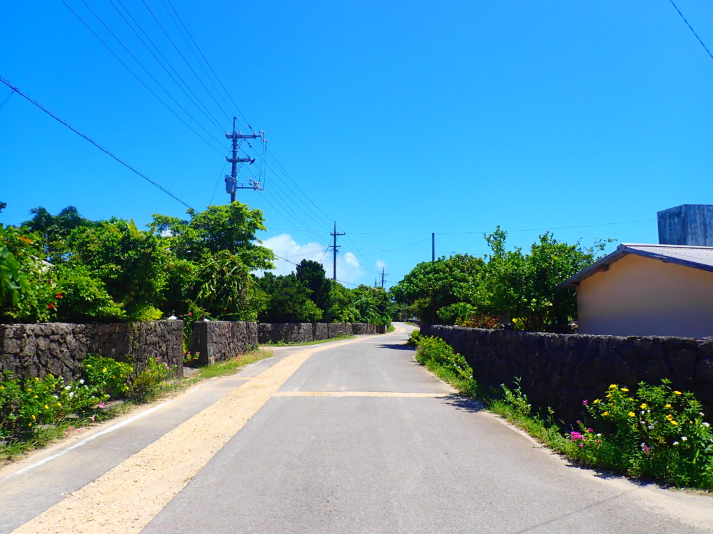
The prefectural road Kuroshima Port Line is the southernmost prefectural road in Japan, connecting Suji Village, the largest village on Kuroshima, with Kuroshima Port. This prefectural road has been selected as one of the 100 best roads in Japan by the Ministry of Land, Infrastructure, Transport and Tourism, and from the road you can see cows relaxing in the pasture.
Location: Kuroshima, Taketomi Town, Yaeyama County, Okinawa Prefecture
Access:-
Parking: None
Meals (nearby): None
Toilet: None
Kuroshima Tourist Spots (3) Miyazato Beach
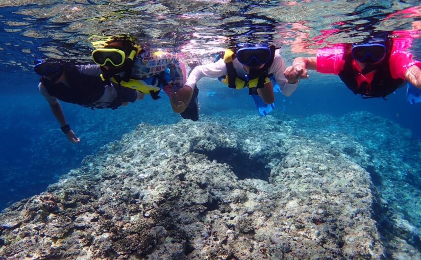
Miyazato Beach is a pristine, unspoiled beach. It is not as well known as Nakamoto Beach on the west coast, the most popular beach on Kuroshima, but it is a secluded spot that offers a private beach experience. This beach is a good place for snorkeling due to its coral reefs and abundance of tropical fish, and it is also the site of the Harvest Festival in July, so you may want to visit in time for the festival.
Location: Kuroshima, Taketomi Town, Yaeyama County, Okinawa Prefecture
Access:-
Parking: None
Meals (nearby): None
Toilet: None
Kuroshima Tourist Attractions (4) Waterworks Monument
In the past, Kuroshima Island did not have a water supply, and well water was the lifeline for the islanders, but in 1975, a monument was erected to commemorate the opening of the water supply.
The water service was opened not only to Kuroshima but also to Iriomotejima and Aragusukujima at the same time. The monument is located along the road from Kuroshima Port to Kuroshima Elementary School, so please stop by.
Location: Kuroshima, Taketomi Town, Yaeyama County, Okinawa Prefecture
Access: None
Parking: None
Meals (nearby): None
Toilet: None
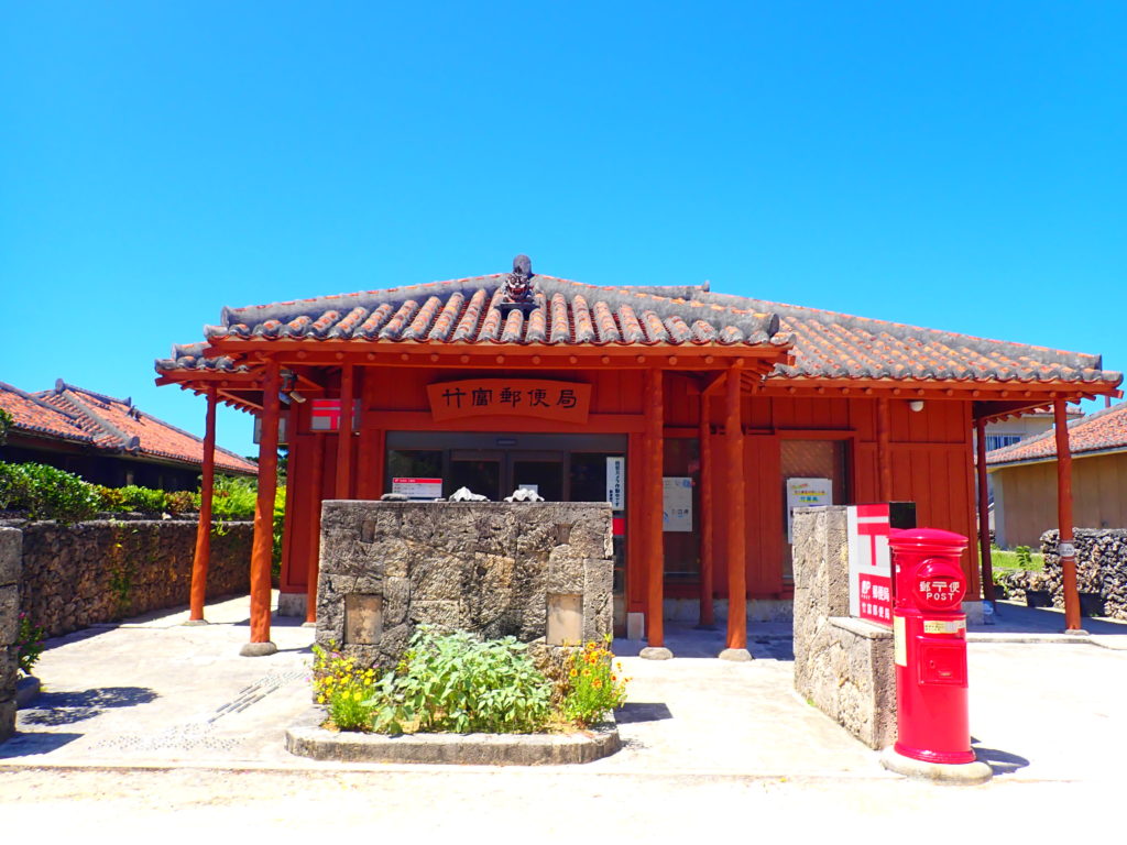
Tourist Spots on Kuroshima Island (5) Kuroshima Post Office
Kuroshima Post Office is the only post office on Kuroshima Island, a typical Yaeyama house with a red-tiled roof. Like mainland post offices, the main post office is open on weekdays and has an ATM.
When you send mail, you will receive a postmark unique to Kuroshima. It may be a good idea to collect postmarks from islands other than Kuroshima, as each island has its own unique postmark!
Location: 1032-1 Kuroshima, Taketomi-cho, Yaeyama-gun, Okinawa
Access: 23 minutes on foot from Kuroshima Port
Parking: Available
Meals (nearby): Available
Toilet: Yes
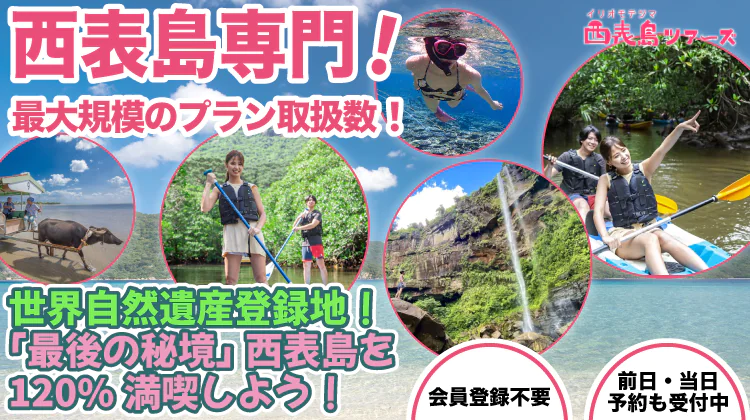
Iriomote
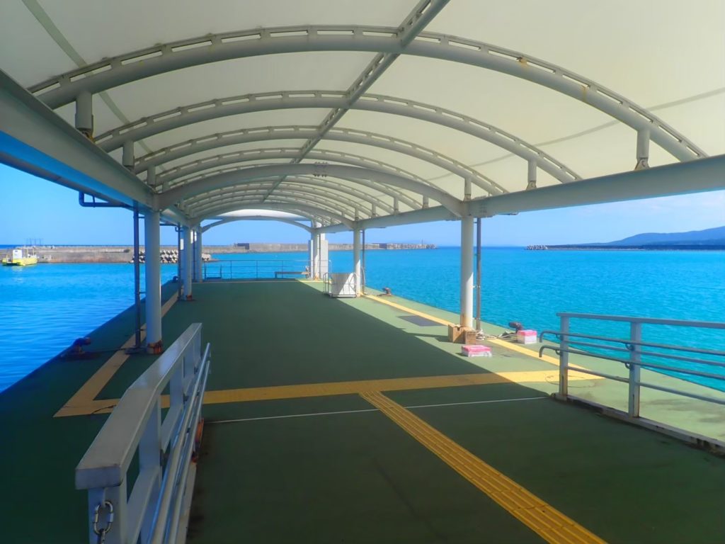
There are two ports in Iriomote Island.
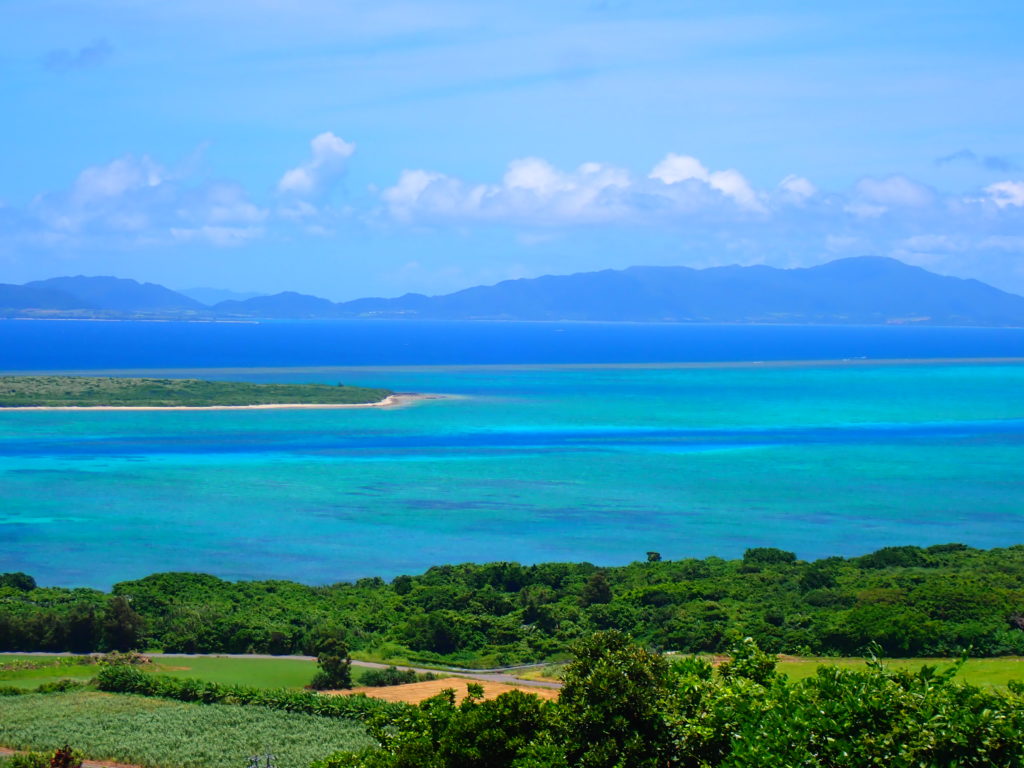
Iriomote Island, known as the Galapagos of the East, is the second largest island in Okinawa Prefecture and the largest in the Yaeyama Islands. Located on the west side of Ishigaki Island, the northern part of Iriomote IslandUehara Portand southwest of the city.Ohara PortThe Ishigakijima Island Terminal provides access to two ports on the island: the Ishigakijima Island Terminal and the Ishigakijima Island Terminal.
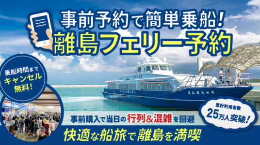
Iriomote Island can only be reached by ferry from Ishigaki Island.
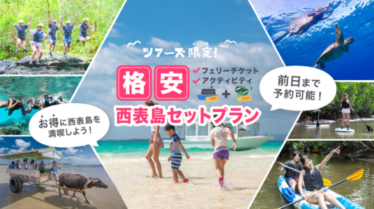
Ferry Tickets and Activitiescheap(at sentence-end, falling tone) indicates a confident conclusionset planYou do not need to purchase a separate ferry ticket if you are
Rather than booking separately.economicalSo, enjoy Iriomote Island sightseeing easily with a set plan!
Click here for popular Iriomote Island tours (set plan)
Check out more details about Iriomote Island tours from Ishigaki Island!
Click here for popular island tours
Access from Ishigaki Island to Iriomote Island
As introduced, when accessing Iriomote Island from Ishigaki IslandUehara Portin line (with)Ohara PortThe ferry will use one of the following two routes. The features of each of the Uehara and Ohara ports, as well as the ferry fare and timetable, are shown below.
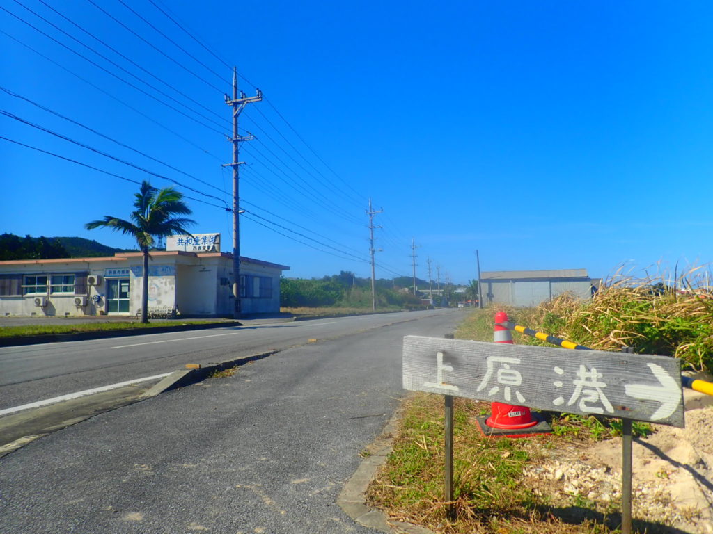
Uehara Port
The shortest way to visit is to take the ferry bound for Uehara Port, which takes about 40 minutes. There are many beaches in the vicinity of Uehara Port, which are suitable for marine activities. There is also Pinaisara Falls, the highest waterfall in Okinawa, and the wide and voluminous Malludu Falls.
Ohara Port
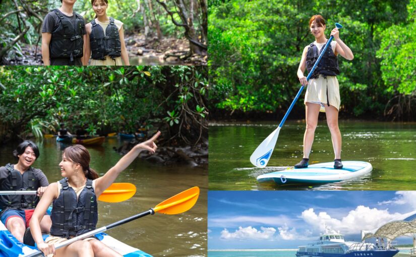
On the other hand, the Nakama River, which has the largest mangrove colony in Japan, flows around Ohara Port, making it suitable for river activities and trekking. Tropical countries have a strong image of the sea, but as mentioned above, subtropical jungle occupies about 90% of Iriomote Island, so mangrove cruising canoeing, jungle trekking, and night tours are very popular compared to other remote islands.
5 Sightseeing Spots in Iriomote Island
Sightseeing Spots in Iriomote Island (1) Pinaisara Falls

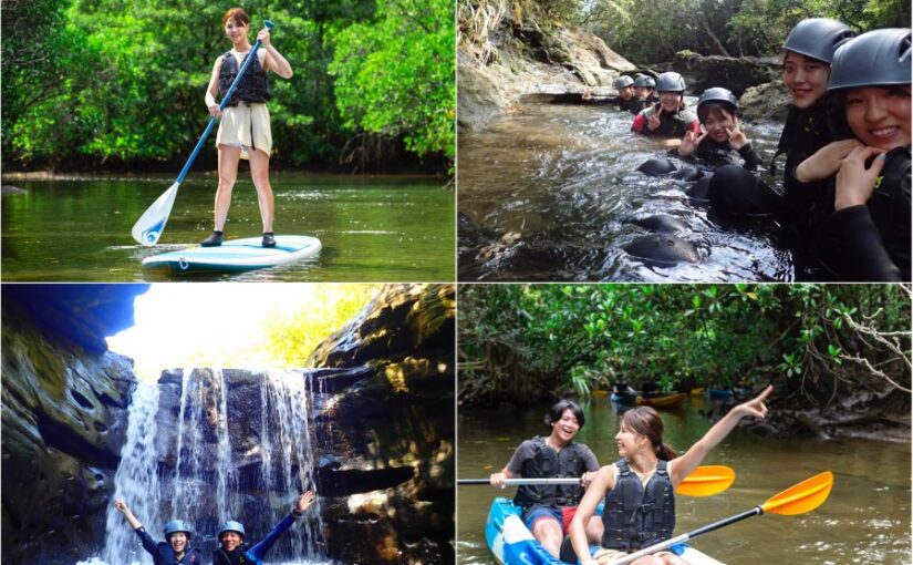
Pinaisara Falls, with the highest drop in Okinawa Prefecture at 55 meters, is one of the most popular tourist spots in Iriomote Island. In the Okinawan language, "Pinaisara" means "beard" and "sahra" means "down," and it looks just like an old man with a long beard. When you see it in person, the forceful force of the waterfall is very powerful.
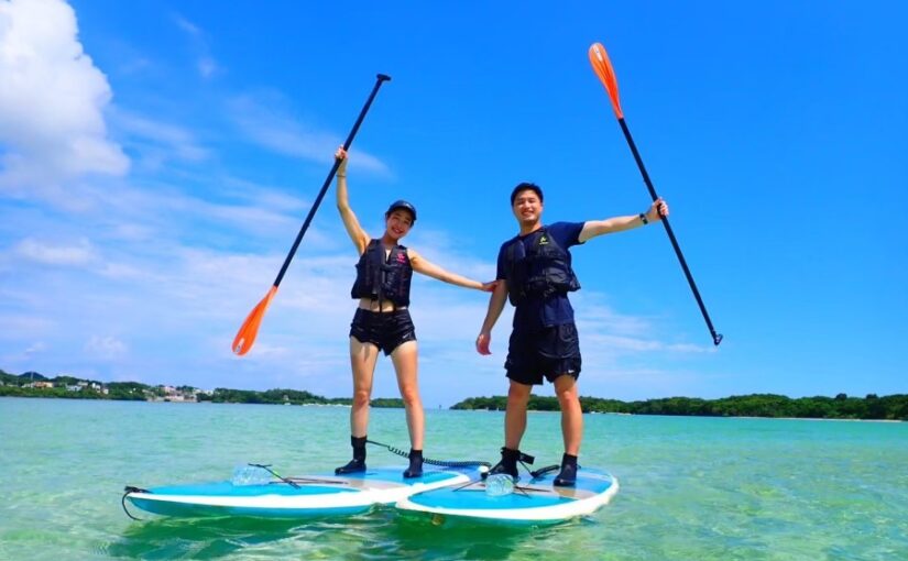
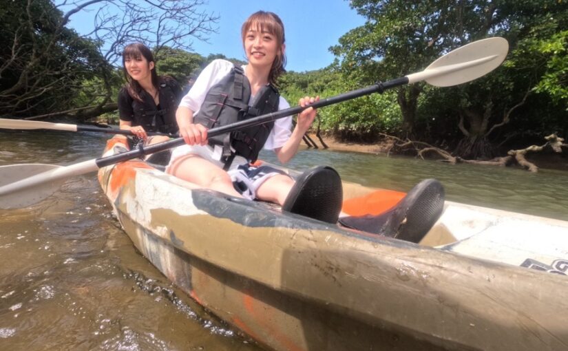
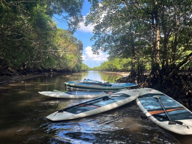
To reach the waterfall, you will need to cruise upstream of the mangrove river by SUP or canoe. After the SUP/canoe cruise, we will trek to the waterfall. The trekking is not very strenuous, so children can participate without any worries. We will continue through the vegetation while observing the unique flora and fauna of the subtropical zone.
You will be amazed at the huge waterfall that appears as the jungle opens up! The waterfall water splashes strongly and you can experience negative ions with your whole body. Inside the waterfall basin, you can also encounter creatures that live in the clear stream, such as gobies, shrimp, and fune amagai. From the top of the waterfall, you can also see Barasu Island, Hatoma Island, and other outlying islands.
For more information on Pinaisara, click here.
Location: Aza-Uehara, Taketomi-cho, Yaeyama-gun, Okinawa
Access: 5 minutes by car from Uehara Port, then about 30 minutes by trekking
Parking: -
Meals (nearby): None
Toilet: None
Sightseeing Spots in Iriomote Island (2) Maludu Falls
Malyudu Falls has a 16-meter drop, not as high as Pinaisara, but the width of the waterfall is 20 meters, making it a very high waterfall. It is a beautiful waterfall that has been selected as one of the 100 best waterfalls in Japan. Mariyudu means "round hollow," and as the name suggests, there are many round, hollow-shaped potholes in the waterfall basin.
Click here for more information about Marudu Falls.
Address: Uehara, Taketomi-cho, Yaeyama-gun, Okinawa
Access: 25 minutes by bus from Funaura Port + 20 minutes by boat, 20 minutes by car from Uehara Port to the mouth of Urauchi River
Parking: No
Dining (vicinity)
Toilet: -
Sightseeing Spots in Iriomote Island (3) Hoshi-suna Beach
Hoshi-suna Beach is one of the most popular beaches on the island with many star-shaped sands on the beach and abundant corals and tropical fishes. Located in the northern part of Iriomote Island, it takes about 5 minutes from Uehara Port by car or 15 minutes by bicycle, so it is easy to visit. Because large rocks are scattered offshore, even on windy days, the waves are not so high and the water temperature is high, making it a perfect beach for those with children!
There are two offshore islands, which can be accessed by swimming from the beach entry. In addition, although Hoshisuna Beach is a shallow beach, tropical fish swim in knee-deep water, and some of them were seen to be over 30-40 cm in length. This beach is home to more than 100 species of colorful tropical fish, so snorkeling can be enjoyed to the fullest. Snorkeling equipment and towels are available for rent at this beach, so you can visit without any equipment! Near the beach is the Restaurant House Hoshinosuna, which is a good place to stop by for a break or to enjoy lunch.
Click here for more information about Hoshisuna Beach.
Click here for activities at Hoshisuna Beach.
Location: Aza-Uehara, Taketomi-cho, Yaeyama-gun, Okinawa
Access: 10 minutes by car from Uehara Port
Parking: Available
Meals (nearby): Available
Toilet: Yes
Iriomote Island Tourist Spots (4) Sonai Hometown Forest
Sonai Hometown Forest is located about 15 minutes by car from Uehara Port, and is spread out around Mt. It is known as one of the best sunset spots on the island, and visitors can enjoy the sunset over Shirahama Bay while relaxing at the rest area and observation deck. Sonai Hometown Forest is also famous as a spot for viewing fireflies, and in early spring, visitors can enjoy the fantastic sight of Iriomote fireflies glowing through the forest. Please enjoy stargazing at the same time.
For more information about Sonai Hometown Forest, click here.
Location: Iriomote, Taketomi-cho, Yaeyama-gun, Okinawa
Access: 15 minutes by car from Uehara Port
Parking: Available
Meals (nearby): None
Toilet: None
Sightseeing Spots in Iriomote Island (5) Nadara River
The river is located in an area near Uehara Port where there is a dense population of Ojirugi and Yaeyama Hirugi.
Continue through the mangroves in a peaceful atmosphere to a small waterfall. Let's go for the healing waterfall.
Activities that can be done on the Nadala River include SUP, canoe cruising, and jungle trekking, which are all the rage nowadays. Pushing through the mangrove river, which has a great atmosphere as if dinosaurs might appear, is very exciting! Jungle trekking early in the morning will give you a sense of unreality as the morning mist rolls in.
Click here for popular tours related to the Nadala River
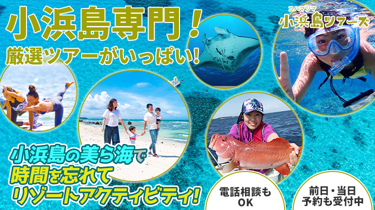
Kohama
Kohama Island is a small island with an area of approximately 8 km2 and a circumference of 16.5 km, and retains a strong landscape of traditional Yaeyama houses and roads. From the 99-meter-high Mt. Ohdake in the center of the island, visitors can enjoy a panoramic view of the entire island and the surrounding islands. The Yugan Festival, held in August of the lunar calendar, is the largest event on Kohama Island and is designated as an important intangible cultural property of Japan. While retaining such traditional townscapes and traditions, the island also offers luxury resort facilities that are typical of tropical resorts, where visitors can spend a luxurious time.
Access from Ishigaki Island to Kohama Island
Kohama Island can be reached from the Ishigaki Island Terminal in about 25 minutes by high-speed boat. The first departure time is at 7:00 a.m., and there are basically hourly departures and arrivals, making it possible to visit Kohama Island on a day trip. The fare and timetable between Ishigaki Island and Kohama Island are as follows.
5 Sightseeing Spots on Kohama Island
Sightseeing Spots on Kohama Island (1) Churasan Plaza
Churasan Plaza is a grassy green plaza on the way to the Odake Observatory in the center of Kohama Island. It is a square that has nothing to do with Churasan, although it seems to have something to do with Churasan since Kohama Island is known as the location of Churasan and it is also named after the island.
However, since this is the largest park on the island, various events are held here, and on the day of the event, it is crowded with many people. Parking and restroom facilities are also available, so it is a good place to take a break.
For more information about Churasan Plaza, click here.
Location: Kohama, Taketomi-cho, Yaeyama-gun, Okinawa
Access: 20-minute walk or 5-minute drive from Obama Port
Parking: Available
Meals (nearby): None
Toilet: Yes
Sightseeing Spots on Kohama Island (2) Ishinagata Beach
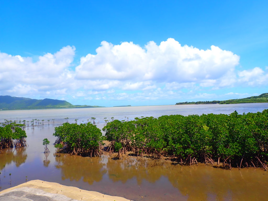
Ishinagata Coast is located in the western part of Kohama Island and extends southward from Akayazaki. The peninsula of Iriomote Island and Kohama Island can be seen on the opposite shore of Ishinagata Beach, and mangrove forests are growing in clusters below. This is one of the only spots on Kohama Island where you can observe the mangroves properly, since subtropical mangroves do not grow as thickly as on Iriomote and Ishigaki Islands." There is a sign that reads "hirugi forest entrance→" and you can follow it to access the mangrove forest and observe the characteristic subtropical flora and fauna. You can also experience SUP and canoeing in the mangrove forests of Kohama Island, and since there are fewer people than on Ishigaki and Iriomote Islands, you can enjoy cruising with a high degree of freedom.
For more information about Ishinagata Beach, click here.
Location: Kohama, Taketomi-cho, Yaeyama-gun, Okinawa
Access: 30-minute walk or 10-minute drive from Obama Port
Parking: Available
Meals (nearby): None
Toilet: None
Kohama Island Attractions (3) Sugar Road
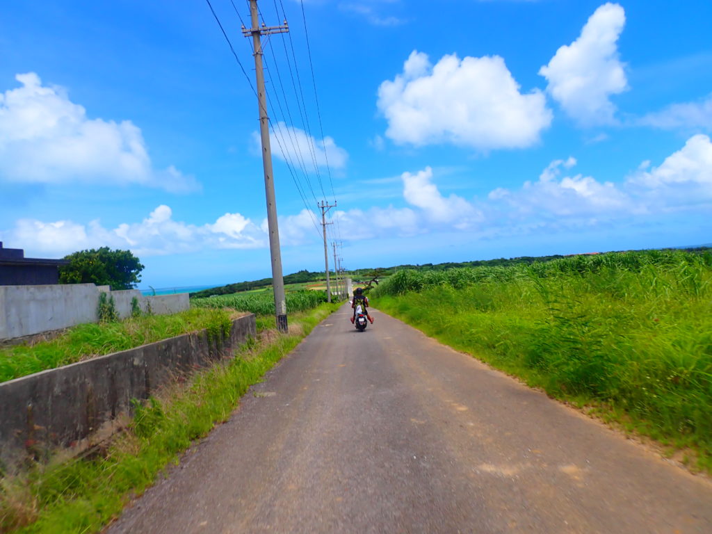
Known as the filming location for the morning drama Churasan, Sugar Road is the most popular tourist spot on Kohama Island. Sugar Road, which seems to stretch endlessly, has downhill and uphill slopes, and along the way you can see sugarcane fields and pastures where cows are taking it easy.
Click here for more information on Sugar Road.
Location: Kohama, Taketomi-cho, Yaeyama-gun, Okinawa
Access: 20-minute walk or 5-minute drive from Obama Port
Parking: -
Meals (nearby): None
Toilet: None
Sightseeing Spots on Kohama Island (4) Tumar Beach
Tumal Beach is a shallow beach perfect for swimming, located about a 10-minute walk or 5-minute drive from Obama Port. There is a pavilion between the main beach and the harbor, so after a good swim in the ocean, you can take a rest in the pavilion while soaking up the sea breeze and waiting for the boats to arrive.
Click here for more information about Tumar Beach.
Click here to play with snorkeling on Kohama Island.
Location: Kohama, Taketomi-cho, Yaeyama-gun, Okinawa
Access: 10-minute walk or 5-minute drive from Obama Port
Parking: Available
Meals (nearby): None
Toilet: None
Sightseeing Spots on Kohama Island (5) Kohagura-so
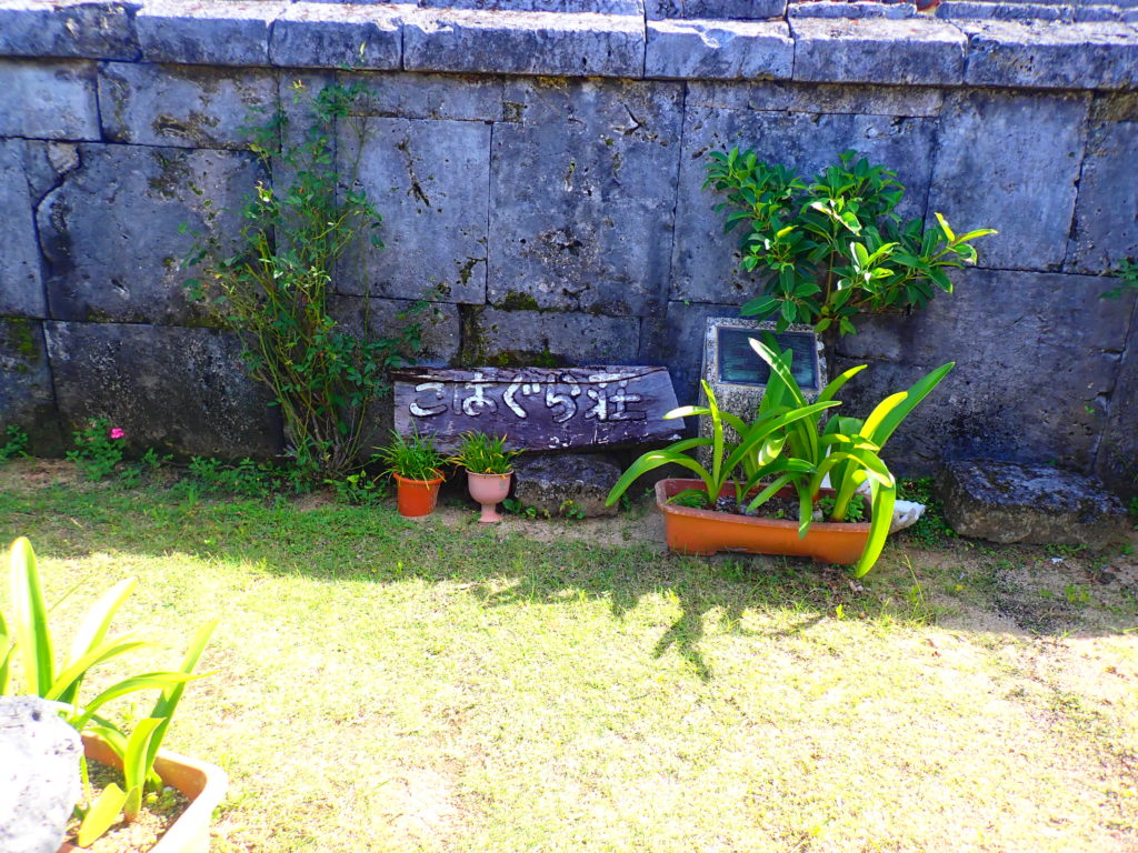
Kohagura-so is a private house that was used as a filming location for NHK's morning drama, Churasan. The stone walls, plastered walls, and red-tile roofs are the original landscape of Okinawa. However, although Kohagura-so was used as a guest house in the drama, you are not allowed to enter the house as it is private property.
Click here for more information about Kohagura-so
Location: Kohama, Taketomi-cho, Yaeyama-gun, Okinawa
Access: 21-minute walk or 6-minute drive from Obama Port
Parking: -
Meals (nearby): None
Toilet: None
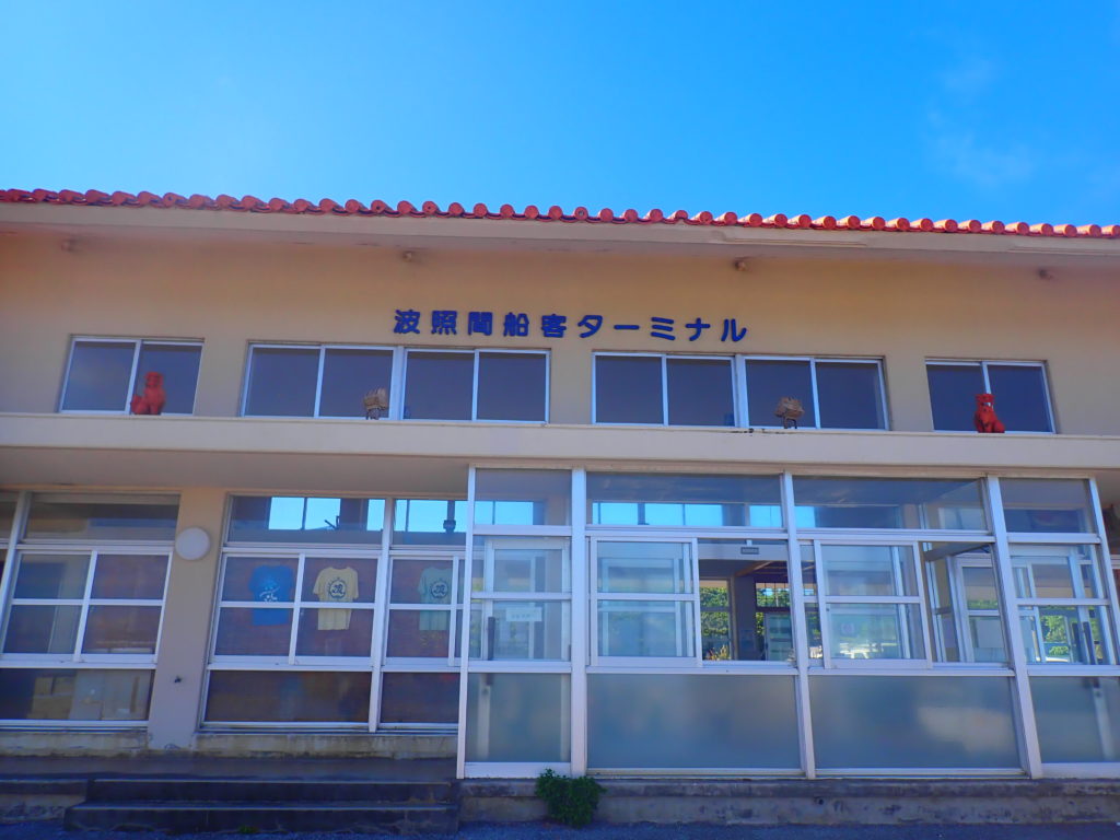
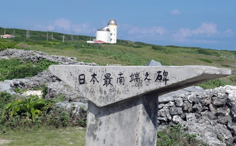
Hateruma Island
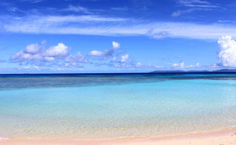
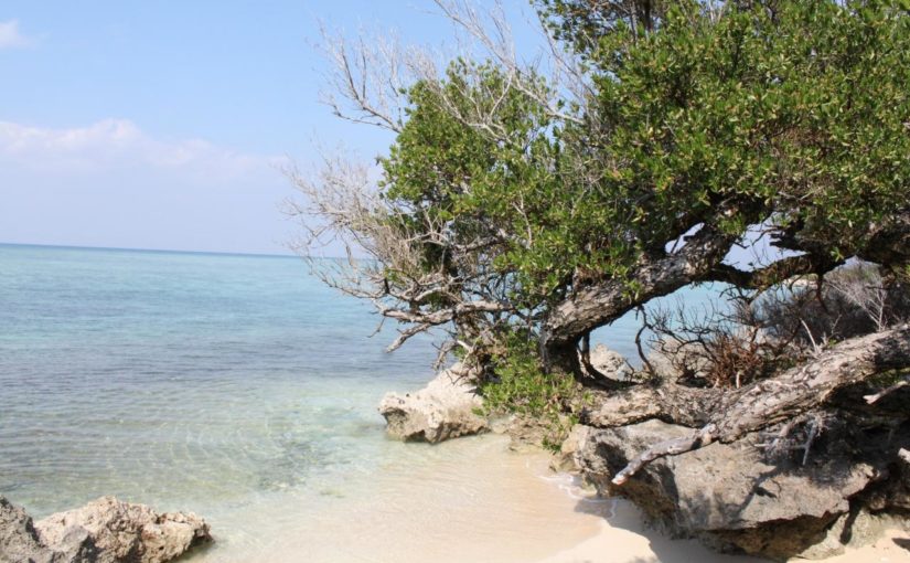
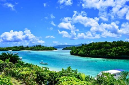
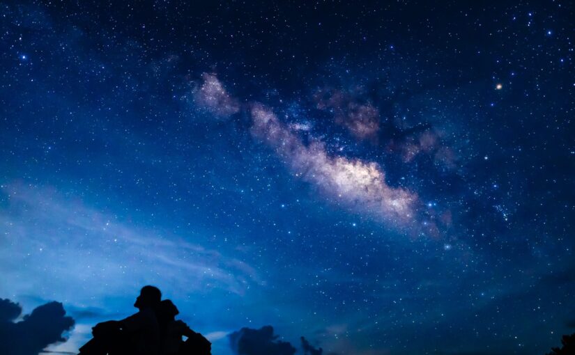
Hateruma Island is a remote island located at the southernmost tip of Japan with a beautiful Hateruma blue color with excellent transparency. The island is an isolated island with little development, and because of its rich nature, it is possible to view a beautiful star-filled sky at night. The name Hateruma Island is said to derive from the coral island of Uruma, and the island is surrounded by coral reefs. The deep blue sea is so clear and beautiful that it is hard not to fall in love with it. Hateruma Island is also home to the most popular southern island beach in Yaeyama, and is a very popular spot for travelers.
Access from Ishigaki Island to Hateruma Island
Hateruma Island is located at the southernmost tip of Japan, so it takes about 60 minutes by small high-speed boat to access the island, and about 90 minutes by Paijima 2. Because of its distance from other islands and the main island, you can experience the beautiful nature of the island. The fare and timetable for Hateruma Island are as follows.
5 Sightseeing Spots on Hateruma Island
Hateruma Island Tourist Spots (1) Nishi Beach
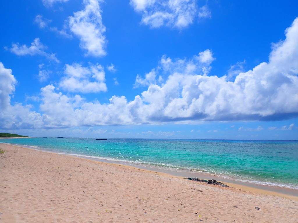
As introduced above, Nishi Beach is the No. 1 popular southern island beach in Yaeyama that travelers adore. This long beach stretches about 1.5 km with silky powdery white sand. The adjacent ocean is a deep, dark blue with excellent transparency. You can enjoy swimming and other activities, but you can also spend luxurious time just admiring the spectacular view because it is so beautiful that it will leave you sighing.
Location: Hateruma, Taketomi Town, Yaeyama County, Okinawa Prefecture
Access: 15 min. walk from Hateruma Port.
Parking: Available
Meals (nearby): None
Toilet: Yes
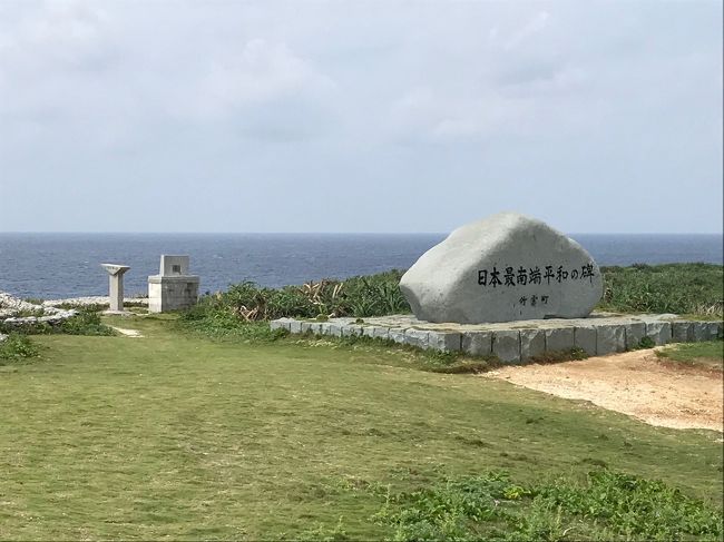
Hateruma Island Tourist Spots (2) Takanazaki, Japan's Southernmost Monument
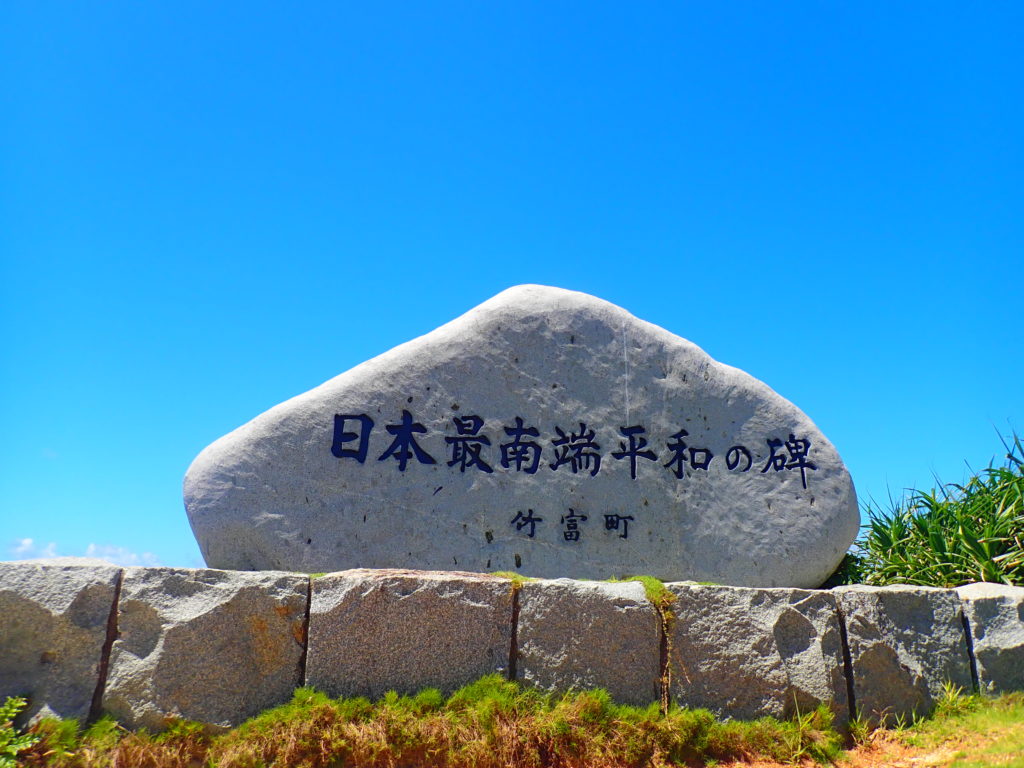
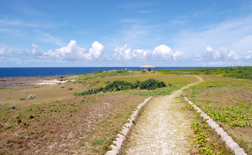
Hateruma Island is the southernmost island in Japan, and there is a monument at Takana-zaki, a cape located at 123°47'12" E longitude and 24°02'24" N latitude at the southernmost point of the island, which is said to have been erected by students who traveled from Hokkaido across Japan in 1972. From Takanazaki, the view of the lapping waves over the precipitous cliffs is very powerful. There is a high point on the cape that offers a very good view and beautiful scenery.
Location: Hateruma, Taketomi Town, Yaeyama County, Okinawa Prefecture
Access: 22 minutes by bicycle from Hateruma Port
Meals (nearby): None
Toilet: None
Hateruma Island Tourist Spots (3) Hamashitan Community
Hamashitan is a tree that grows on top of raised coral with a large trunk that twists and turns. The hamashitan colony consists of more than 20 hamashitan trees with a height of 3.5 m and a trunk circumference of 2 m. Some of the trees are several hundred years old and are designated as natural monuments of Taketomi Town. Some of the trees are several hundred years old and are designated as natural monuments of Taketomi Town. There is also a coral beach next to the hamashitan colony, so be sure to check it out!
Location: Hateruma, Taketomi Town, Yaeyama County, Okinawa Prefecture
Access: 15 minutes by bicycle from Hateruma Port
Parking: None
Meals (nearby): None
Toilet: None
Hateruma Island Tourist Spots (4) Hateruma Elementary School
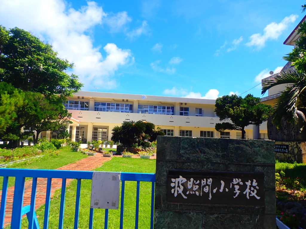
Hateruma Elementary School, located in the center of the island, is the only elementary school on Hateruma Island and the southernmost elementary school in Japan, where all islanders attend. Seven goats are raised on the school grounds.
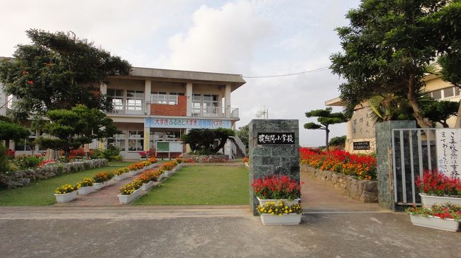
Location: 54 Hateruma, Taketomi-cho, Yaeyama-gun, Okinawa, Japan
Access: 18 minutes on foot from Hateruma Port Passenger Terminal
Parking: None
Meals (nearby): None
Toilet: None
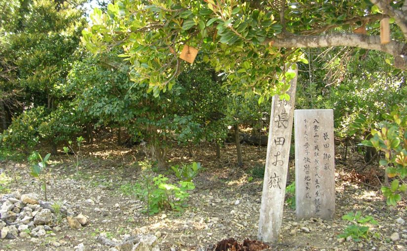
Hateruma Island Tourist Attractions (5) Nagata Utaki
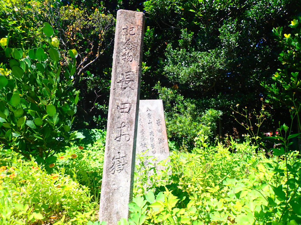
Nagata Utaki This is the Utaki of Ufunushi, a hero from Hateruma Island in the late 15th century. He is a chief of Ishigaki Island who is known to have been a powerful man together with Oyakeakahachi, a great hero. There is only a monument stone and it is a place of worship for the islanders. It is surrounded by lush greenery and has an atmospheric atmosphere.
Location: 106-2 Hateruma, Taketomi-cho, Yaeyama-gun, Okinawa, Japan
Access: 10 min. walk toward Chuo village from Hateruma Port Hateruma Passenger Boat Terminal
Parking: None
Meals (nearby): None
Toilet: None
Yonaguni Island
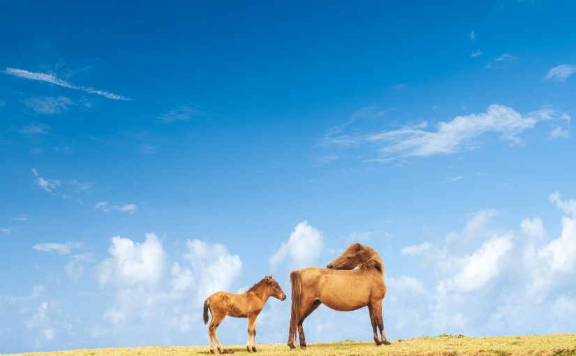
Yonaguni Island is the westernmost island in Japan, and is also about 111 km from Taiwan, making it closer to overseas than to the mainland. Many people may know Yonaguni Island as the location for the TV drama Dr. Koto Clinic. Of course, visiting the filming location is a standard sightseeing tour, but there are also many other attractions that will tickle your curiosity, such as the mysterious undersea ruins that sink near the island, strangely shaped rocks, and the point where the sun sets the latest in Japan. At the cape located at the westernmost tip of the island, visitors can experience horseback riding with the Yanaguniuma, a species endemic to the island. The entire island is dotted with tourist spots, and since it is not a very large island, you can visit all of them!
Access from Ishigaki Island to Yonaguni Island
There are only two regular weekly boat services from Ishigaki Island to Yonaguni Island, the westernmost island in Japan, so please be careful when visiting the island.
Ferry Timetable between Ishigaki Island and Yonaguni Island
Click here for the ferry timetable of Yonaguni Island ↓ Click here for the ferry timetable of Yonaguni Island
Ferry Timetable from Ishigaki Island to Yonaguni Island
5 Sightseeing Spots in Yonaguni Island
Tourist Spots on Yonaguni Island (1) Japan's westernmost monument
Yonaguni Island, the westernmost island in Japan, like Hateruma Island, has a monument at the westernmost point of the island (24°26'58" N, 122°56'01" E).
On the back of the stone monument are inscribed the distances to domestic and foreign cities, confirming that Taiwan is closer than the main island, and in fact, on a clear day, you can even visually see Taiwan. You can even see Taiwan visually on a clear day.
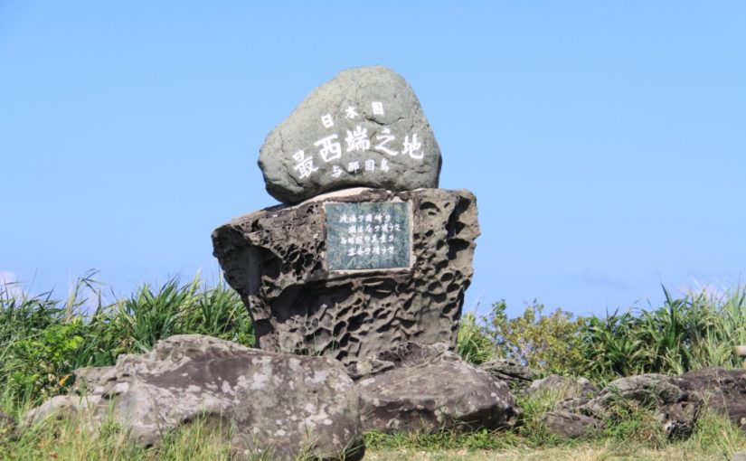
Location: Yonaguni, Yonaguni Town, Yaeyama County, Okinawa Prefecture
Access: 15 minutes by car from Yonaguni Airport
3 minutes drive from Kubura Port
Parking: Available
Meals (nearby): None
Toilet: None
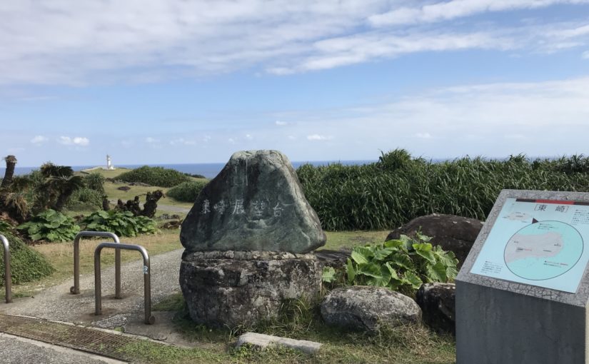
Sightseeing Spots on Yonaguni Island (2) Higashizaki Observatory
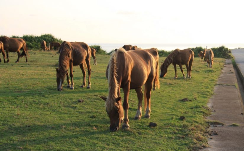
Higashizaki Observatory is located in the eastern part of Yonaguni Island and offers a view of the island and the surrounding sea. The surrounding area is a vast grassland where Yonaguni horses and cows graze, and visitors can interact with them. In the early morning, you can see the beautiful sunrise rising over the horizon.
Location: Yonaguni, Yonaguni Town, Yaeyama County, Okinawa Prefecture
Access: 15 minutes by car from Yonaguni Airport
Parking: Available
Meals (nearby): None
Toilet: Yes
Tourist Spots in Yonaguni Island ③Minami Ranch
Minami Ranch is located in the southern part of Yonaguni Island and is famous for the TV drama Dr. Coto Clinic. The ranch is surrounded by Texas gates, through which visitors enter to see free-roaming horses living in the pasture.
Location: Yonaguni, Yonaguni Town, Yaeyama County, Okinawa Prefecture
Access: 10 minutes by car from Yonaguni Airport
Parking: Available
Meals (nearby): None
Toilet: None
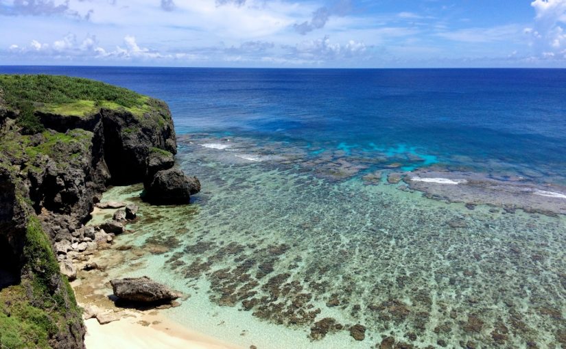
Sightseeing Spots on Yonaguni Island (4) Rokutatami Beach
Rokutatami Beach is a natural beach located in the northern part of the island and is known as the most beautiful beach in Yonaguni Island. As the name "Rokutatami Beach" suggests, it is a very small and unexplored beach that almost disappears at high tide. It is surprisingly difficult to find because it is located at the bottom of a precipitous cliff through the grass and trees. It is impossible to find unless it is at low tide, so be sure to check the tide table before visiting. It is truly a hole-in-the-wall beach that was featured as a secret location in the TV drama Dr. Koto Clinic.
Location: Yonaguni, Yonaguni Town, Yaeyama County, Okinawa Prefecture
Access: 10 minutes by car from Yonaguni Airport
Parking: None
Meals (nearby): None
Toilet: None
Sightseeing Spots on Yonaguni Island (5) Dr. Koto Clinic
The sightseeing spot introduced to coral reefs is Dr. Coto Clinic. In fact, the location set used in the filming of Dr. Koto Clinic has been preserved as it was in the drama, not only in the waiting room and office, but also in the props. Admission is only 300 yen, and the unattended vegetable sales are also popular tourist attractions.
A ladder behind the entrance leads to the rooftop, from which you can see the sandy beach and the beautiful ocean.
Location: Yonaguni, Yonaguni Town, Yaeyama County, Okinawa Prefecture
Access: 10 minutes by car from Yonaguni Airport toward Kataburu Beach
Parking: Available
Meals (nearby): None
Toilet: None
Hatoma
Hatoma Island is a small island with an area of about 1 km2 located in the northern part of Iriomote Island. The sea surrounding the island is a beautiful lapis lazuli color and is called Hatoma blue, or Hatoma Island is called Ruri no Shima. The sea of Ruri no Shima is one of the clearest among the seas of the Yaeyama Islands, and the fish inhabiting the Hatoma Blue seem to be swimming comfortably. Many people enjoy snorkeling in the sea where coral remains untouched and untouched. You can enjoy a slow island time in the lapis lazuli color on such a nature-rich Hatoma Island.
Access from Ishigaki Island to Hatoma Island
There are two types of flights from Ishigaki Island to Hatoma Island: direct and via Uehara Port on Iriomote Island. The former takes about 40-45 minutes to reach the island, while the latter takes about 70 minutes. The timetable and fare for the ferry between Ishigaki Island and Hatoma Island are as follows.
5 Sightseeing Spots on Hatoma Island
Sightseeing Spots on Hatoma Island (1) Hatoma Island Lighthouse
Hatoma Island Lighthouse is located in Hatoma Nakamori, the highest point on the island, which can be reached by a 10-15 minute walk from Hatoma Port toward the center of the island. The lighthouse is characterized by its white color that appears in the middle of the forest. Although you cannot enter the lighthouse, you can see Iriomote Island, Kohama Island, and other islands from the high point from which you can see the whole island.
For more information about Hatoma Island Lighthouse, click here.
Address: Hatoma, Taketomi-cho, Yaeyama-gun, Okinawa
Access: 10 minutes by boat from Uehara Port, 15 minutes on foot from Hatoma Port
Parking: No
Meals (nearby): None
Toilet: No
Sightseeing Spots on Hatoma Island (2) Five Brothers Banyan Tree
The Five Brothers Banyan Tree is a banyan tree with five plants in a well-balanced arrangement and is located across from the Senju Banyan Tree. The Senju Banyan Tree is so named because it is divided into five branches, while the Senju Banyan Tree has large spreading branches.
For more information on the Five Brothers Banyan Tree, click here.
Address: Hatoma, Taketomi-cho, Yaeyama-gun, Okinawa
Access: 10 minutes by boat from Uehara Port, 40 minutes on foot from Hatoma Port
Parking: None
Meals (nearby): None
Toilet: None
Sightseeing Spots on Hatoma Island (3) Yara Beach
Yara Beach is one of the larger beaches on the island with a wide sandy beach and is crowded with tourists during the summer season. The waves are calm and it is a suitable spot for bathing and snorkeling. It is also famous as a spot with a spectacular view of Iriomote Island and sunset.
For more information about Yara Beach, click here.
Click here for snorkeling tours of Hatoma Island
Name: Yara Beach
Address: Hatoma, Taketomi-cho, Yaeyama-gun, Okinawa
Access: 10 minutes by boat from Iriomote Island
Parking: -
Meals (nearby): None
Toilet: None
Hatoma Island Tourist Attractions (4) Birthplace of Hatoma Elementary School
Hatoma Elementary School had a long history established in the Meiji era, but after depopulation, the elementary and junior high schools were merged. The current school building was moved to the sea side, and a monument to the birthplace of Hatoma Elementary School was erected on the grounds of the Hatoma Island Community Center. The current school building is located next to the beach in front of the school, and although it is in a good location, it was once in danger of being closed due to a decrease in the number of students due to depopulation and declining birth rates. However, thanks to the efforts of the islanders, the school is still in operation today by promoting study abroad programs on the remote islands.
For more information on the birthplace of Hatoma Elementary School, click here.
Address: Hatoma, Taketomi-cho, Yaeyama-gun, Okinawa
Access: 10 minutes by boat from Uehara Port, 3 minutes walk from Hatoma Port
Parking: No
Meals (nearby): None
Toilet: No
Hatoma Island Sightseeing Spots (5) Married Couple Rocks
Husband and Wife Rocks are huge rocks located near Tachihara Beach in the northwestern part of Hatoma Island, and there is a signboard nearby. The rock is named after a married couple who lived nearby. However, there are other rocks scattered around the area, so it is sometimes difficult to tell who is the husband and wife rock at first sight. It is a good idea to ask the locals.
Click here for more information about Married Couple Rocks.
Address: Hatoma, Taketomi-cho, Yaeyama-gun, Okinawa
Access: 10 minutes by boat from Uehara Port, 15 minutes on foot from Hatoma Port
Parking: None
Meals (nearby): None
Toilet: None
Extra - Islands without regular boats
Barras Island
Barasu Island is an uninhabited island located between Ishigaki Island and Iriomote Island. Barasu Island is also called "Miracle Island," and there are two main reasons why it is so called. The first is that the island appears and disappears depending on the tide level. The second is that the islands are formed entirely of coral fragments. In the northern hemisphere, Barras is the only island made entirely of coral fragments. In the Southern Hemisphere, there are only two, making it a true miracle.
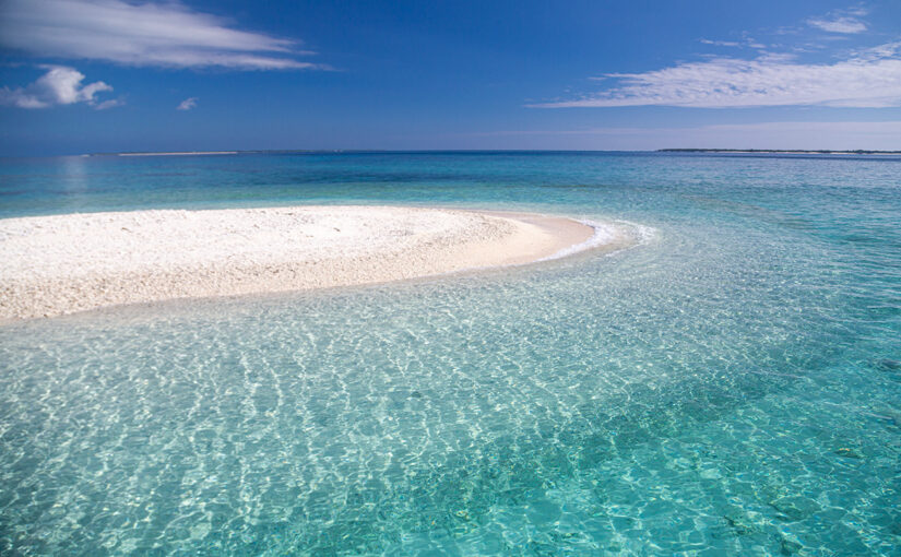
Access from Ishigaki Island to Barasu Island
Barasu Island is an uninhabited island that appears at different tidal levels and is devoid of vegetation. It is difficult to go to Barasu Island alone. Therefore, it is usually accessed by snorkeling tours or landing tours. It takes about 10 minutes from Uehara Port to Barasu Island by boat. The boat ride is not very long, so even those who suffer from severe seasickness can go without worry. If you are still concerned, take an anti-sickness medicine beforehand.
phantom island
There is an island with similar characteristics to Barasu Island called Hamashima (Phantom Island). Phantom Island is a small crescent-shaped uninhabited island located between Ishigaki and Iriomote Islands, and is similar to Barasu Island in that it disappears and appears depending on the difference in tidal levels. The contrast between the pure white sandy beach and the emerald green sea that stretches 360 degrees around the island is very beautiful. Although the waters around Hamashima are shallow, they are knee-deep and teeming with coral and an abundance of tropical fish. As you go offshore, the ocean's hues change in a gradation of colors at varying depths, which is very nice. Also, offshore is the Ishisei lagoon, the largest coral area in Japan, where you can encounter more than 400 species of coral, fish, sea turtles, and manta rays.

Access from Ishigaki Island to Phantom Island
Like Barasu Island, Phantom Island is not served by airplanes or regular high-speed flights, so if you wish to visit the island on your own, you will need to access it by boat from a tour company. There are activity tours departing from Taketomi Island, Kohama Island, and Ishigaki Island, which are the surrounding islands of Phantom Island. Be sure to select a suitable tour from the islands you will be using.
Information on access from each of the islands is provided below.
Access to Phantom Island (1) From Ishigaki Island
It takes about 30 minutes from Ishigaki Island to Phantom Island by boat. There are many tours from Ishigaki Island to Phantom Island, so it is easy to join. Compared to other islands, the boat ride is longer and the arrival time may vary due to the speed of the boat depending on the wave conditions.
Access to Phantom Island (2) Departure from Kohama Island
Kohama Island is about 5 km away from Phantom Island, which can be reached by boat in about 15 minutes. Kohama Island retains the original landscape of Okinawa, while there are also resort hotels with abundant leisure facilities. Therefore, it is a good idea to spend a night on Kohama Island and join a tour to the island.
Access to Phantom Island (3) Departure from Taketomi Island
Since it takes only 20 minutes by boat from Taketomi Island to Phantom Island, a combination tour of Phantom Island and Taketomi Island sightseeing is often offered. It is a good plan to join the Phantom Island tour in the evening and return to Ishigaki Island.
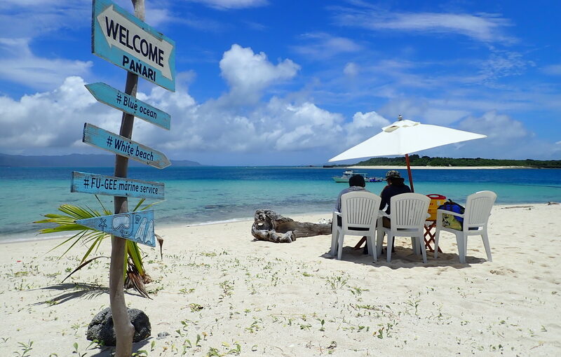
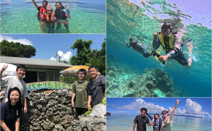
New Castle Island
Aragusuku Island, also called Panari Island, is a remote island located in the southeast of Iriomote Island belonging to the Yaeyama Islands. Aragusuku Island is close to Kuroshima Island and Ishigaki Island, so Aragusuku Island sightseeing tours are also available. Aragusuku Island is a combination of two islands, the long and narrow Kamiji Island in the northeast and the round Shimoji Island in the southwest. The island is unique in that the two islands are separated from each other, and is called Panari-jima, from the Yaeyama dialect panari, meaning "away. Kamiji Island is 2.4 km long and 5 km in circumference, with a small island community and accommodations.
The accommodations are well-equipped with Internet access, so you can spend your time without any inconvenience. Because a secret festival is held on the island, there are signs prohibiting photography and sound recording at various locations on the island. Shimoji Island, on the other hand, is characterized by flat terrain with few slopes, and ranches occupy most of the island. This ranch is called Panari Ranch and is managed by only two islanders on Shimoji Island. There are many ruins and sightseeing spots throughout Shimoji Island, making it an ideal place for sightseeing. The island's crystal-clear waters attract thousands of visitors every year.
Access from Ishigaki Island to Aragusuku Island
Although Aragusuku Island is inhabited, like Phantom Island (Hamashima) and Barasu Island, there is no regular boat service. Therefore, visitors to the island must use regular boats for sightseeing. Most Aragusuku Island sightseeing tours leave Ishigaki Island around 9:00 am and return to Ishigaki Island Port Terminal around 5:00 pm.
5 Sightseeing Spots on Aragusuku Island
Sightseeing Spots on Aragusuku Island (1) Koijiga-hama Beach
Koijigahama is a quiet natural beach located in the western part of Quinupana, about a 3-minute walk from the port of Kamiji Island. Not many tourists visit the beach, and the rocks surrounding the beach give it a private beach feel. The beach is not suitable for snorkeling or diving due to the lack of coral reefs and tropical fish, but children can safely enjoy swimming in the shallow water. The area is surrounded by Utaki (sacred Utaki), which are off-limits to visitors, so be sure to go with a guide.
Address: 180 Shinshiro, Taketomi Town, Yaeyama County
Access: 3 min. walk from the port
Sightseeing Spots on Aragusuku Island (2) Panari Farm
As mentioned above, Panari Ranch is a ranch that takes advantage of the flat land with few differences in elevation on Shimoji Island. It is managed by two islanders of Shimoji Island. The cows living comfortably in the lush green land that stretches across the island look very comfortable. There are only two islanders living on the island, so it is one of the islands where you can really feel the remoteness of the island. If you want to spend your time in a relaxed atmosphere, it is a good idea to visit Shimoji Island and enjoy Panari Farm.
Address: Shinshiro, Taketomi Town, Yaeyama County, Okinawa Prefecture
Sightseeing Spots on Aragusuku Island (3) Kita-no-hama
Kitanohama is a natural beach that has been left untouched by human hands and can be reached in about 5 minutes on foot from the port and village of Kamiji Island. Compared to other isolated islands, Aragusuku Island is less developed and has fewer residents, so the beach has been left in its natural state.
The clear waters are also teeming with a wide variety of eda corals and tabletop corals, and are home to an abundance of tropical fish. Sea turtles visit the beach every year to lay eggs, so it is a spot where you may encounter sea turtles when snorkeling. Why don't you try snorkeling at the beach of Aragusuku Island, which is called the best in Yaeyama?
Access: 5 min. walk from the port and village
Sightseeing Spots on Aragusuku Island (4) Quinupana
As mentioned briefly above, Kuinupana is an observation deck located at the top of a flight of stone wall stairs in the western part of Kamiji Harbor on Kamiji Island. The name "Kuinupana" is a combination of "kui" meaning high ground and "pana" meaning edge in the local language. From the high ground of Kuinupana, you can see the surrounding outlying islands such as Iriomote Island, Shimoji Island, and Aragusuku Island, as well as the crystal clear ocean. Quinupana is a popular sightseeing spot on Aragusuku Island, so it is an essential place to visit when you visit Kamiji Island.
Address: Shinshiro, Taketomi Town, Yaeyama County, Okinawa Prefecture
Access: 2 minutes on foot from Kamiji Port
Aragusuku Island Tourist Attractions (5) Hateruma Muri (Sakishima Islands Hibanzori)
Hateruma muri is a hibanzori established in 1644 by the Ryukyu Kingdom under the rule of the Satsuma Clan. Hateruma Muri is located on the south side of Shimoji Island, and Takaniku is located in the northern part of Kamiji Island. Hateruma Muri, located on the south side of the center of Shimoji Island, is in Panari Farm, and there are no signs to guide you there, so it is very difficult to get there. If you really want to visit there, we recommend that you take a sightseeing tour that includes a visit to Hateruma Muri. Hateruma Muri has a stone wall that may have been used in the past, from which you can see the whole Aragusuku Island. The site is currently unused and unmanaged, so it is overgrown with plants and trees, but you can experience the unique atmosphere of the ruins.
Address: Shinshiro, Taketomi Town, Yaeyama County, Okinawa Prefecture
summary
- The remote islands of the Yaeyama Archipelago can be reached by ferry from Ishigaki Island!
- Iriomote Island hasUehara PortandOhara PortNote that there are two ports of
- Some islands, such as "Phantom Island," "Barasu Island," and Aragusuku Island, can only be reached by taking a tour!
We have introduced information on ferries in Ishigaki Island and the accessible islands. How was it? There are islands that can be easily accessed from Ishigaki Island, and there are also islands that have no regular ferry service and only operated by tour boats. All islands have many attractive points, so please visit them. Thank you for reading to the end.


")