

Ishigaki Island-Fukitsu River Tideland
Early reservations are recommended as they fill up quickly.

◆Tuk-tuks and electric trikes are also popular!

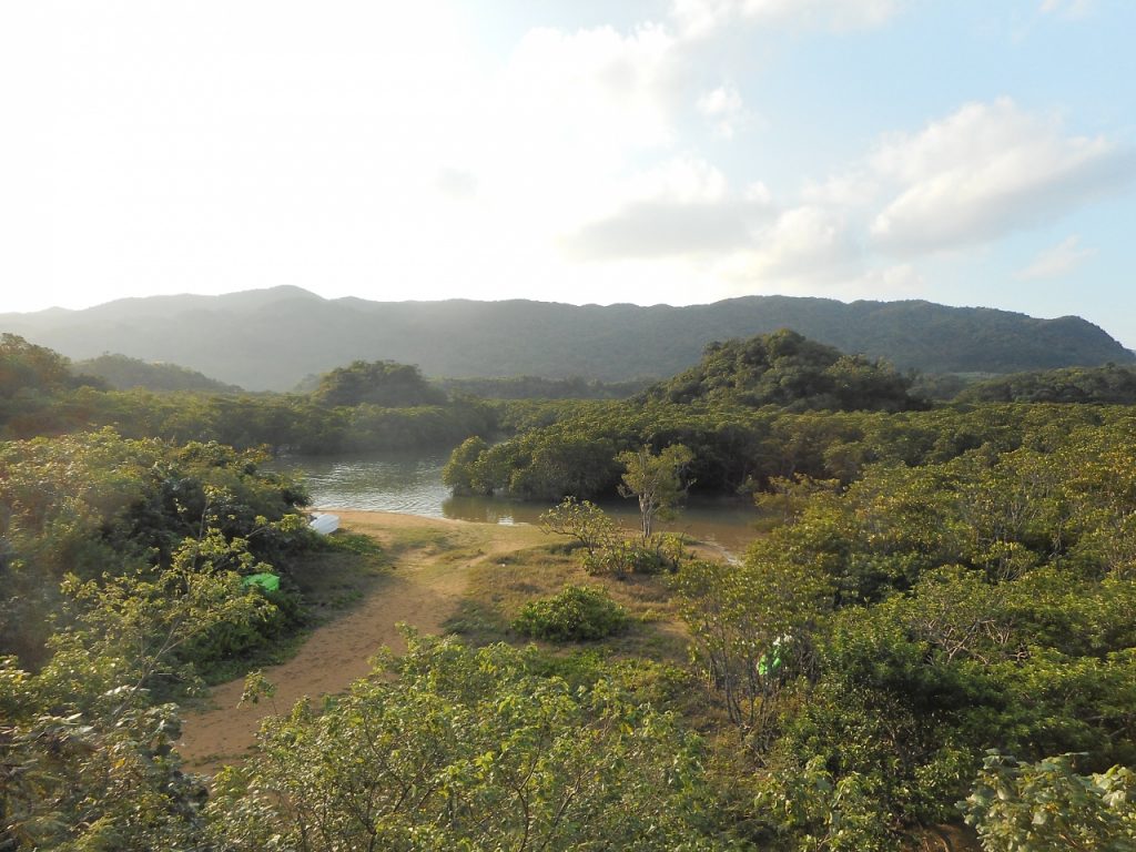
About the Fukidori River Tidal Flat
On the north side of Ishigaki Island,river running between Tokyo-to and Kanagawa PrefectureA tidal flat stretching out near the river mouth.
All aroundA grove of mangrovesis spreading.
At high tide, it is filled with seawater, but at low tide, a mudflat appears.
The tidal flats of the Fukidori River areNeizo AnpalUnlike other tidal flats, this one consists mainly of sandy bottom, and in addition to fiddler crabs and other crabs, you can encounter many hermit crabs here.
Also, since the area is mostly sandy, you can easily walk around in flip-flops, making it simple to enjoy observing the tidal flats.
The river water is crystal clear and beautiful, so you can have fun playing in the river♪
Related columns are here↓.
11 Recommended Plants You Can Find on Ishigaki Island and Iriomote Island
How to Get to the Fukidori River Tidal Flat
The Fukidori River is located about a 40-minute drive from the city center, about a 35-minute drive from the Remote Islands Terminal, and about a 20-minute drive from New Ishigaki Airport.
・When traveling from the city center
Head north on Prefectural Road 87, pass through the Omoto Tunnel, and at the T-intersection where Prefectural Road 79 joins, turn right toward Nosoko.
There’s a bus stop called ”Ota” on the coastal road; if you turn right there, you’ll arrive at your destination.
・If you're coming from New Ishigaki Airport
After leaving New Ishigaki Airport, turn left and head north on Route 390.
Cross the river, turn left at the first Y-intersection, continue straight ahead, and merge onto Route 79, following the road.
If you drive a little further, you'll come to the Fukidori Bridge; park there and go down the stairs to access the site.
How to Enjoy the Fuki-tsu-gawa Tidal Flat
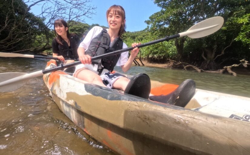
At the Fuki-dori River tidal flats, you can enjoy a mangrove canoe (SUP) tour at low tide.
river running between Tokyo-to and Kanagawa PrefectureMany of the subtropical creatures living there are probably ones you’ve never seen before.
On a typical tour, you’ll take a cruise along the mangrove-lined river to view the mangrove forests, then hop off onto a kayak (SUP) to explore the mudflats.
After that, it’s common to take a hiking tour to the waterfall.
Click here for related activities

Click here for related activities
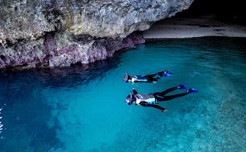
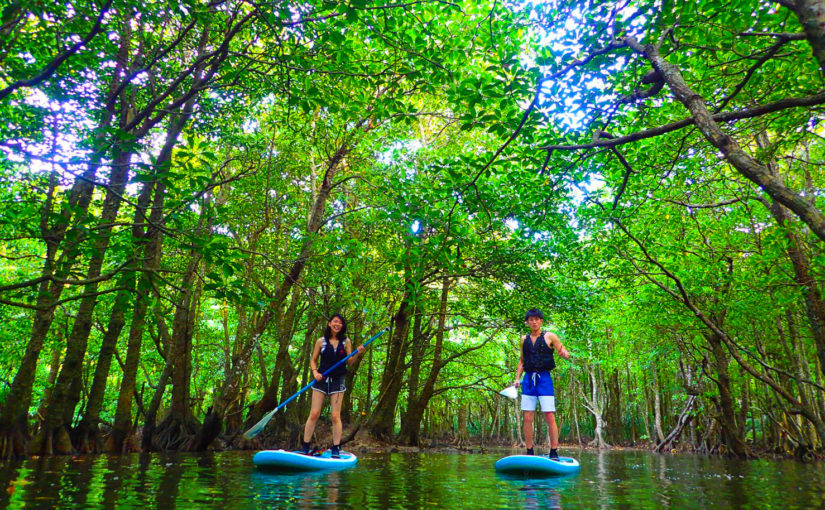
![Okinawa, Ishigaki Island] [Yabiku Waterfall] Aim for the "Waterfall of Marriage"! Mangrove Canoe & Shower Trekking Tour (No.308)](https://ishigaki-tours.com/wp-content/uploads/2017/12/P5120889-825x510.jpg)
Details on the Fukitsugi River Tidal Flat
The Fukitsugi River Tidal Flat is a tidal flat that appears near the mouth of the Fukitsugi River at low tide; the area is also home to natural mangrove forests and serves as a habitat for many species.
When they are visible, you can spot creatures such as crabs and gobies, as well as crab burrows.
In addition, at low tide, when the mudflats are exposed, you can see the full extent of the mangrove roots and take your time observing species such as the Yaeyama mangrove, with its unusual, octopus-like roots, and the black mangrove, with its knee-shaped roots.
Since the types of mangrove plants vary depending on the salinity of the water, be sure to enjoy observing the changes in the vegetation when you take part in a canoeing or SUP tour.
When the tidal flats are exposed, you can see lots of crab burrows and small, dumpling-like objects.
These dumpling-like things are left behind after crabs filter out organic matter to feed on, so if you look around here, you'll be able to find some crabs.
At low tide, you can walk across the mudflats to go quite far, so be sure to visit during low tide.
Creatures of the Fukidori River Tidal Flat
・Southern Flying Goby
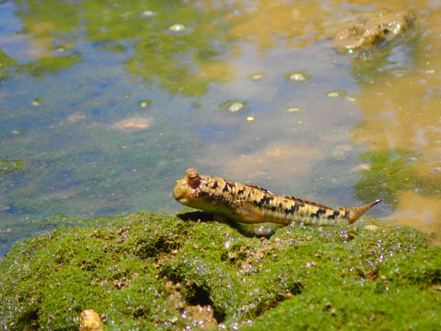
The Southern Leaping Goby is a species of goby found in the brackish waters of rivers, tidal flats, and mangrove areas in subtropical and tropical climates; it is charming to watch as it leaps across the tidal flats.
It is affectionately known as “Tontonmi” by the locals.
・Yaeyama Fiddler Crab
The Yaeyama fiddler crab is a species of fiddler crab found on some of the remote islands of the Yaeyama Islands.
Males have large pincers on their right arms and use them to perform courtship displays.
Because its movements appear to be calling in the tide as the tide begins to rise rapidly, it is called a fiddler crab. Since it moves quickly, it’s best to observe it from a distance.
・Southern Spiny Crab
The Southern Spiny Crab is a cute crab with a spherical body and eyes that seem to protrude upward.
Because they tend to form groups, they are called "army crabs."
・Red-spotted Maneki-neko
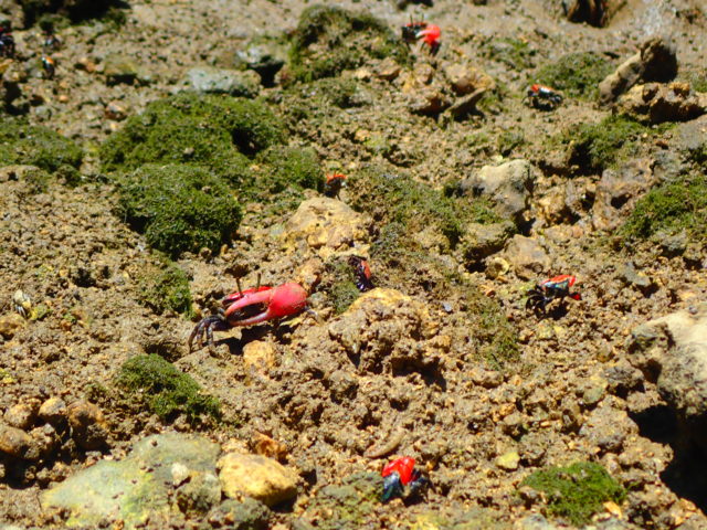
The Red Fiddler Crab is a relative of the Fiddler Crab mentioned above, and this species has large claws that are a matte red color.
It is known as the reddest species of fiddler crab.
Recommended Sightseeing Spots Near the Fukidori River Tidal Flats
Edna Beach
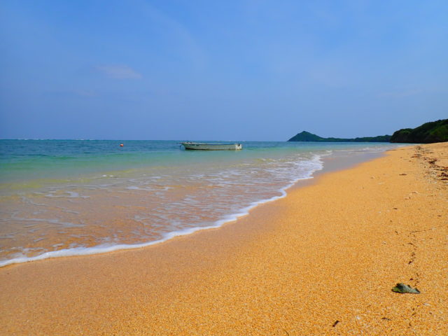
To get to Idona Beach from the Fukidori River tidal flats, head south on Route 79.
When you see Orion Ishigaki Island Eco Tour Service on your left, turn right and follow the road; you’ll see Idona Beach ahead.
Idona Beach is home to an abundance of coral and tropical fish, and there is a dive shop nearby.
That's why it's a beach where you can enjoy snorkeling and diving.
Since there are fewer tourists here than at other beaches, you can enjoy observing wildlife with greater freedom.
Since it's located on the West Coast, it's a great spot to watch the sunset.
Idona Beach is known for its reddish sand, and at dusk, the reddish hue becomes even more pronounced, offering a view unlike any other.
In addition, since the Idona settlement is located near this beach, it is also a popular spot among locals.
Address: Ukimi, Ishigaki City, Okinawa, Japan
Access: 25 minutes by car from Shin-Ishigaki Airport, 35 minutes by car from Ishigaki Port Terminal
Hours of operation: None
Usage fee: Free of charge
Facilities: vending machines available
Toilet: None
Parking : Available
Anti-hub jellyfish net: No
Observer: None
Inoda Fishing Port
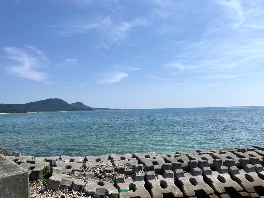
To get to Inoda Fishing Port from the Fuki-dori River tidal flats, head south on Route 79.
When you see Stardust Villa Milky Way on your left, turn left at the next Y-intersection.
Follow the road for a while, then turn left at the end of the road.
After turning onto Route 390, we’ll head north for a while.
Cross the river and turn right at the third T-intersection.
If you turn right at the end of the road, you'll find Inoda Fishing Port.
Since Inoda Fishing Port is a fishing port, there aren’t many tourists—just the islanders enjoying a bit of fishing—but it’s actually a hidden gem.
From here on, there are glass-bottom boats with transparent glass bottoms, so you can observe marine life without even getting in the water.
Even young children and seniors who can't go in the water can enjoy it together with everyone else.
Also, because it is located on the island's east coast, you can enjoy watching the sunrise over the beautiful horizon.
Address: Momori, Ishigaki City, Okinawa Prefecture
Directions: A 40-minute drive from downtown Ishigaki City.
Parking: Available
Nosoko Observation Deck
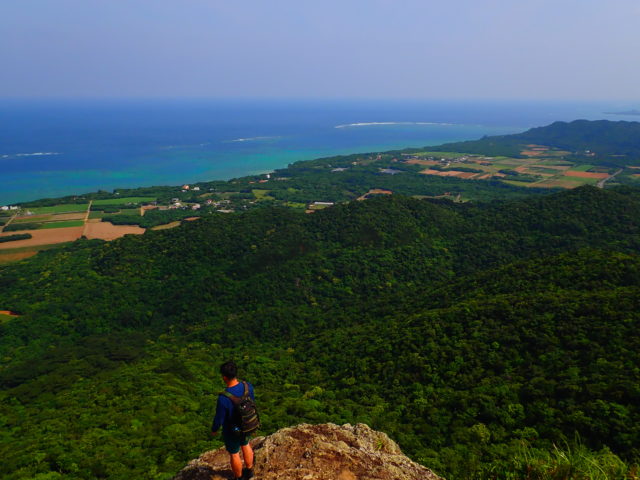
To reach the Nosoko Observation Deck, turn right after leaving the Fukidori River tidal flats and head north on Route 79.
Continue along the road for a while, and when you see ISHIGAKI LABO on your right, turn right at the next Y-intersection.
If you follow the path up Mt. Nosoko, you’ll arrive at the Nosoko Observation Deck.
The Nosoko Observation Deck is located on Mount Nosoko, famous for the Mape legend, and offers panoramic views of the sea around Ishigaki Island, the summit of Mount Nosoko, and the entire island.
If you follow the narrow forest road off Prefectural Route 78, you’ll find the trailhead for Mt. Nosoko; from there, you can walk to the observation deck.
Since it's located along the path to the summit, it's the perfect spot to take a break.
When you reach the summit, there’s nothing to block your view, so you can enjoy a 360-degree panoramic view.
There’s also the Marpe Rock, famous from the Marpe legend. It’s said that touching it will improve your luck in love, so be sure to give it a try.
Location: Nosoko, Ishigaki City, Okinawa Prefecture
Access: 1 hour by car from the remote island terminal
Parking: None
Meals (nearby): None
Toilet: None
Details on the Fukitsugi River Tidal Flat
| Location | Nosoko, Ishigaki City, Okinawa, JapanView in MAP) |
| Access | About a 35-minute drive from the Remote Islands Terminal; about a 20-minute drive from Ishigaki Airport |
| parking lot | ant |
| toilet | ant |
| Business Hours | - |
Related columns are here↓.
Let's play in the great nature mangrove of Ishigaki Island!
See all activities
Ishigaki Island Tours






















































![[Ishigaki Island / Approx. 2.5 hours] Same-day reservations accepted! SUP tour to the mystical “Blue Cave”★ A new experience in crystal-clear waters♪ Free photos](https://ishigaki-tours.com/wp-content/uploads/2017/12/DB89F99F-C338-4E76-BC19-CEC4FDDE95AC-1-825x510.jpeg)