







Taketomi Island - Arei Utaki -
Early reservations are recommended as they fill up quickly.

◆Tuk-tuks and electric trikes are also popular!

What Is Arei (A-rei) Ontake?
Arei (A-re) Utaki is a sacred site located right near the Nbufuru Observation Deck. Since there are sightseeing buses and rental bicycles available, it’s a great spot to explore the island. This particular Utaki isn’t very well known, and since it’s overgrown with vegetation, it might be hard to spot, so it’s a good idea to ask a local for directions.
How to Get to Arei Utaki
Arei Utaki is located about a 17-minute walk or a 6-minute drive from Taketomi Port.
From Taketomi Port, head straight toward the village; turn left at Nakasuji Well, then turn right immediately afterward, and you’ll find Arei Utaki on your left.
How to Enjoy Arei Utaki
There are many tourist attractions in the area around Arei Utaki, including Sachimoto (Konami) Utaki, Nbufuru Hill, Nakasuji Well, and the former Yonaguni Government Housing Complex. There’s also a bike rental shop called Taketomi, so you can explore the island by renting a bike.
Details on Mount Ontake
Arei Utaki is located southeast of the Nbufuru Observation Deck. Details regarding its origin and other aspects are unknown. In Okinawa, places of worship—which correspond to shrines on the mainland—are called “utaki” (御嶽), but on Taketomi Island, these sites are referred to by various names such as “on” (御嶽), “yama” (山), “taki” (嶽), and “muru” (杜).
There are 86 sacred sites on Taketomi Island, and 28 of them are said to be called “Utaki.” Among the many places of worship on Taketomi Island, the most important are the “Mūyama” (Six Mountains) within the Utaki. This term means “six places of worship” and refers to sites dedicated to the six chieftains said to be the island’s founders. It is also said that each of these Utaki was once home to its own village. In addition to the Mūyama, there are four other Utaki known as Mura-on (Village Utaki), which serve as the center of Taketomi Island’s festivals.
Recommended Sightseeing Spots Near Arei Utaki
Kohamoto Utaki
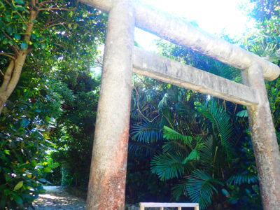
Sachimoto (Kohamoto) Utaki is a sacred site located south of Nbufuru Hill, which was introduced earlier. While there are few Shinto shrines in the Yaeyama Islands, including Taketomi Island, there are many sacred sites called “utaki” where Okinawan deities are enshrined. There are 28 Utaki on Taketomi Island, six of which are called “Mūyama” and are considered the most important; the Kōmoto (Konamoto) Utaki is one of these Mūyama. In addition to this Utaki, there are several other famous Utaki within the village, such as Nishitou Utaki, so be sure to visit them as well.
Location: Taketomi, Taketomi Town, Yaeyama County, Okinawa Prefecture
Access: 8 minutes by car from Taketomi Port
Parking: None
Meals (nearby): None
Toilet: None
Nbufuru Hill
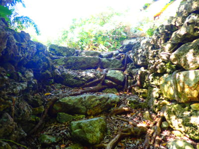
Nbufuru Hill is located toward the southern end of the village on Taketomi Island, and the observation deck built on top of it stands at the highest point on the island. Since Nagomi Tower is more famous, few people are aware of this, but in fact, the Nbufuru Observation Deck is the highest point on the island.
There is an interesting anecdote about how this hill came to be. Long ago, a cow kept in the village escaped one night and used its horns to form this hill. The next morning, the cow was found on top of the hill mooing "Nmbufuru, Nmbufuru," so the hill was named Nmbufuru Hill.
The Nmbufuru Observation Deck, built on this hill at an elevation of 20 meters, once offered views of the townscape of Taketomi Island, as well as Iriomote Island and Ishigaki Island. Although it is currently closed to the public, along with the Nagomi Tower, you should still take a moment to check it out while you’re in the area.
Location: Taketomi, Taketomi Town, Yaeyama County, Okinawa Prefecture
Directions: About a 19-minute walk from Taketomi Port
Parking: None
Meals (nearby): None
Toilet: None
well
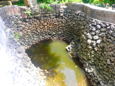
The Nakasuji Well is located right next to Nmbfulu Hill, and due to its abundant water supply, it served as a vital lifeline for the villagers until the public water system was established.
There is a legend associated with this well.
Taketomi Island is frequently struck by drought, and the islanders suffer as a result. During one such drought, the villagers were puzzled when a dog they kept returned with a wet tail; when they followed the dog, they discovered this well. It’s as if the dog had said, “Dig here, woof woof!” Because the well yielded an abundant supply of water, it was cherished for special occasions such as the New Year’s “first water” ritual and the “birth water” ceremony for new mothers.
Location: Taketomi, Taketomi Town, Yaeyama County, Okinawa Prefecture
Access: 20 minutes on foot from Taketomi Port
Parking: None
Meals (nearby): None
Toilet: None
Details on Arei (A-rei) Utaki
| Location | Taketomi, Taketomi Town, Yaeyama County, Okinawa Prefecture |
| Access | About a 19-minute walk from Taketomi Port |
| parking lot | nashi (Pyrus pyrifolia, esp. var. culta) |
| toilet | nashi (Pyrus pyrifolia, esp. var. culta) |
| Business Hours | - |
































































![[Ishigaki Island / Approx. 2.5 hours] Same-day reservations accepted! SUP tour to the mystical “Blue Cave”★ A new experience in crystal-clear waters♪ Free photos](https://ishigaki-tours.com/wp-content/uploads/2017/12/DB89F99F-C338-4E76-BC19-CEC4FDDE95AC-1-825x510.jpeg)