")


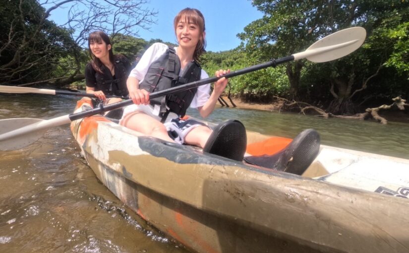
Ishigaki Island - Miyara River
Check it out and make a reservation early☆.
⬇︎Tuk-tuks and electric trikes are also rapidly gaining popularity☆


What is the Miyara River?
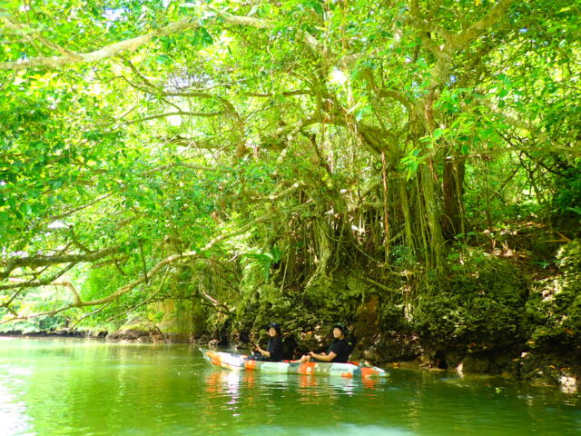
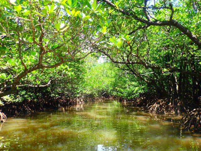
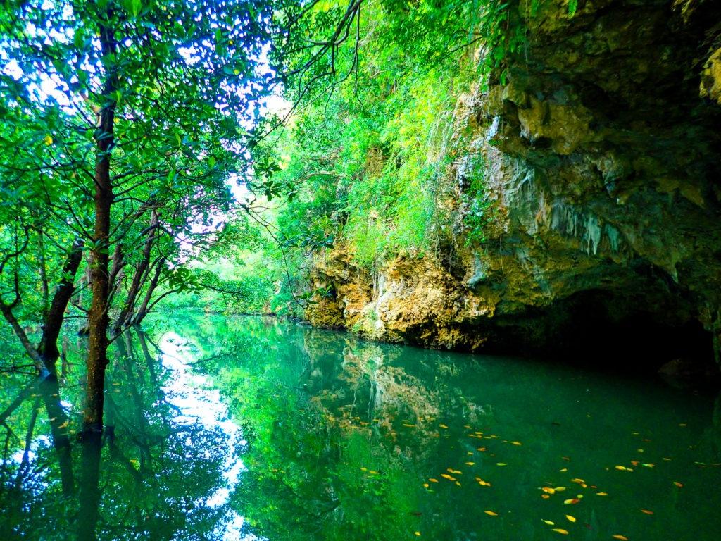
The Miyara River isThe longest river on Ishigaki Island, with a total length of 12 kmIt is a jungle-like river with dense stands of mangroves stretching upstream about 1.5 km from the mouth.
The Miyara River is home to an abundance of plants from the Rhizophora family—such as Yaeyama Rhizophora and common Rhizophora, which form mangrove forests—creating a unique atmosphere.
Also, “Banyan Tree (Tree of Happiness)"You can also watch it."
↓Click here for more information about mangroves↓
The Miyara River makes a significant contribution to the ecosystem of Ishigaki Island and plays an important role as a water source for land improvement projects.
Several dams have been built near the headwaters, and the river flows on to fields of sugarcane and pineapples—Ishigaki Island’s main local products—as well as rice paddies.
The Miyara River is a vital waterway that plays a major role in supporting the daily lives of the island’s residents!
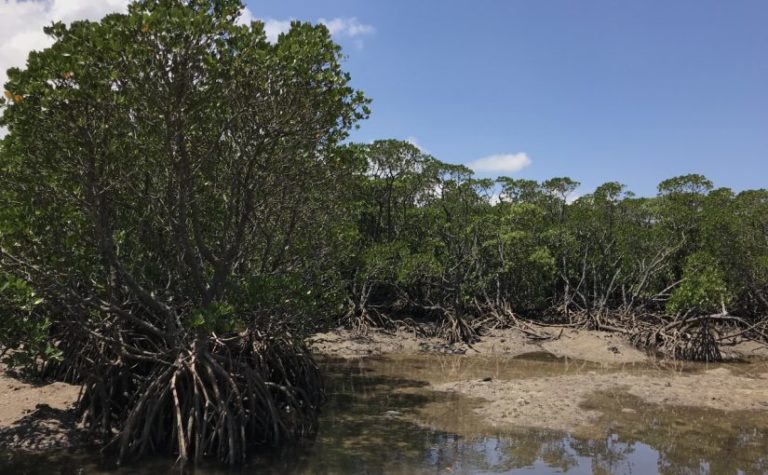
What Is a “Mangrove Forest,” a Type of Plantation Found Along the Miyara River?
Mangrove forests are a unique type of community found from the tropics through Taiwan and Okinawa to Kagoshima Prefecture, forming dense stands in marshy areas such as coastlines and estuaries.
The mangrove forest along the Miyara River stretches 1,500 meters along both banks from the river mouth upstream, covering an area of 225 hectares (equivalent to about 48 Tokyo Domes). It is a large mangrove community consisting primarily of species such as *Rhizophora mucronata*, *Rhizophora stylosa*, and *Rhizophora yaeyamae*.
In addition to the species mentioned above, you can also find “banyan,” “hamanatsume,” “kakatsugayu,” “hime-turtle,” “Okinawa sharinbai,” “sarukake mandarin,” and “adan,” among others.
↓Learn more about the mangrove forest along the Miyara River↓
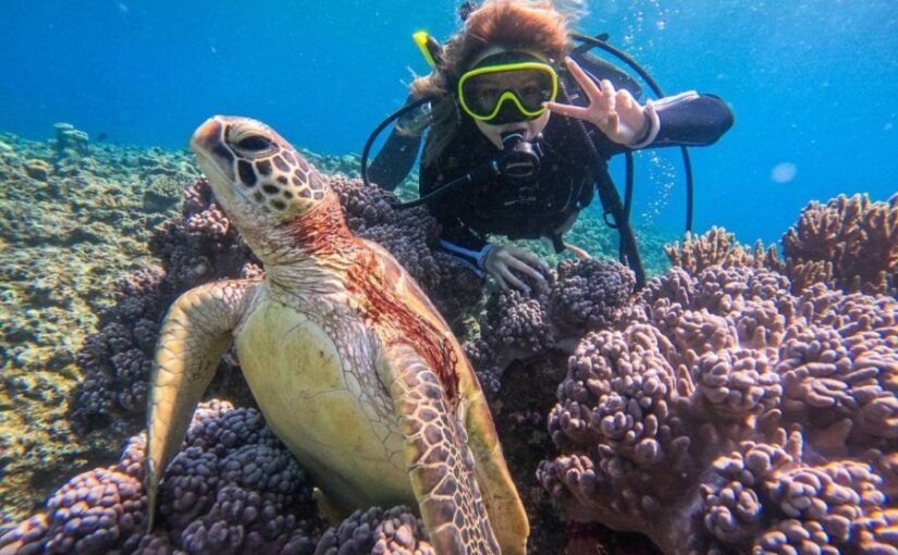
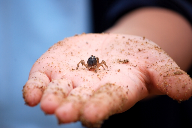
Creatures Found in the Miyara River
At the Miyara River, mudflats appear at low tide, where you can see the charming sights of gobies, crabs, and other creatures. Migratory birds also sometimes stop by.
The mangrove forests along the Miyara River, which provide such a wide variety of ecosystem services,Designated as a National Natural Monument in 1972The first time the company was founded, it was a "new" company.
How to Get to the Miyara River
The Miyara River is located between New Ishigaki Airport and the city center; it takes about 10 minutes by car from New Ishigaki Airport and about 15 minutes by car from the city center to reach it.
It’s in a very convenient location, just about 15 minutes from the airport by local bus.
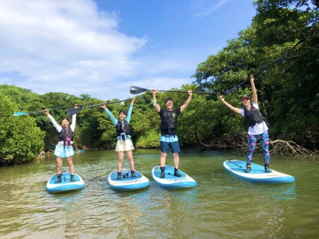
Things to Do on the Miyara River
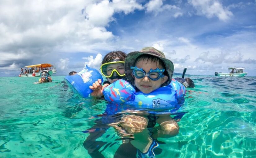
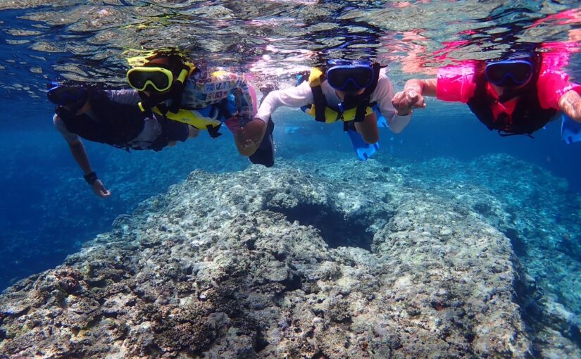
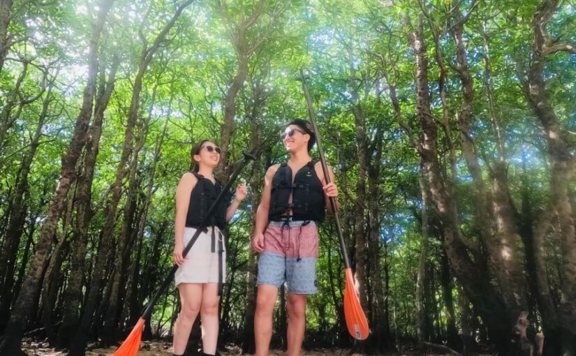
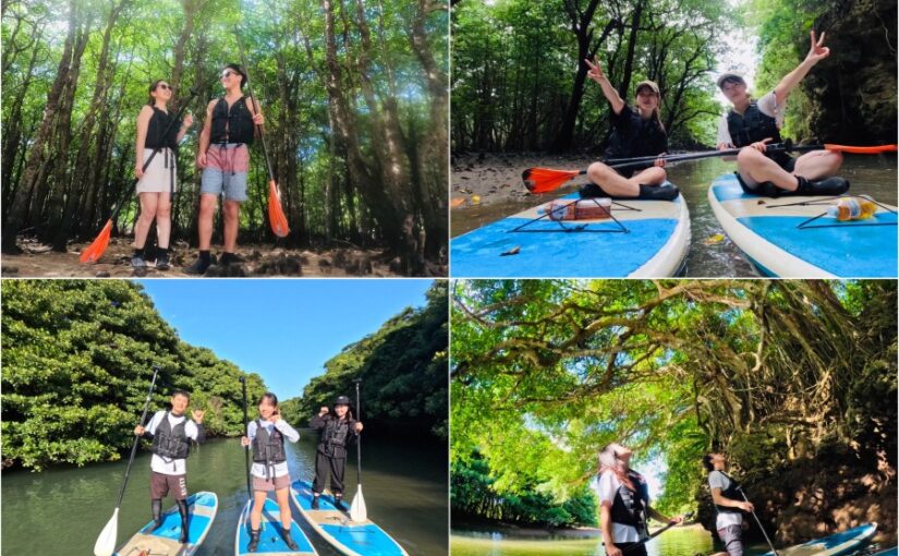
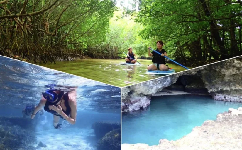
Canoeing and stand-up paddleboarding (SUP) are popular activities on the Miyara River.
Since the mangrove forests act as a breakwater, shielding the area from rain and wind, you can enjoy activities on the calm water, soRecommended for families with young childrenÂ
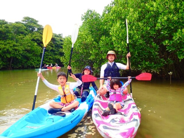
Unlike other areas, the Miyara River is close to both the Ishigaki Island Remote Islands Terminal and Ishigaki Airport, andThe tour lasts 2 hoursSince the tour is short, you can easily join it even if you’ve just arrived on Ishigaki Island or are short on time on your last day.
Why not take an elegant cruise down Ishigaki Island’s premier mangrove river?
↓Held at Miyara River! Click here for popular tours

See more tours held at Miyara River
Recommended Spots Near the Miyara River
Ohama Beach
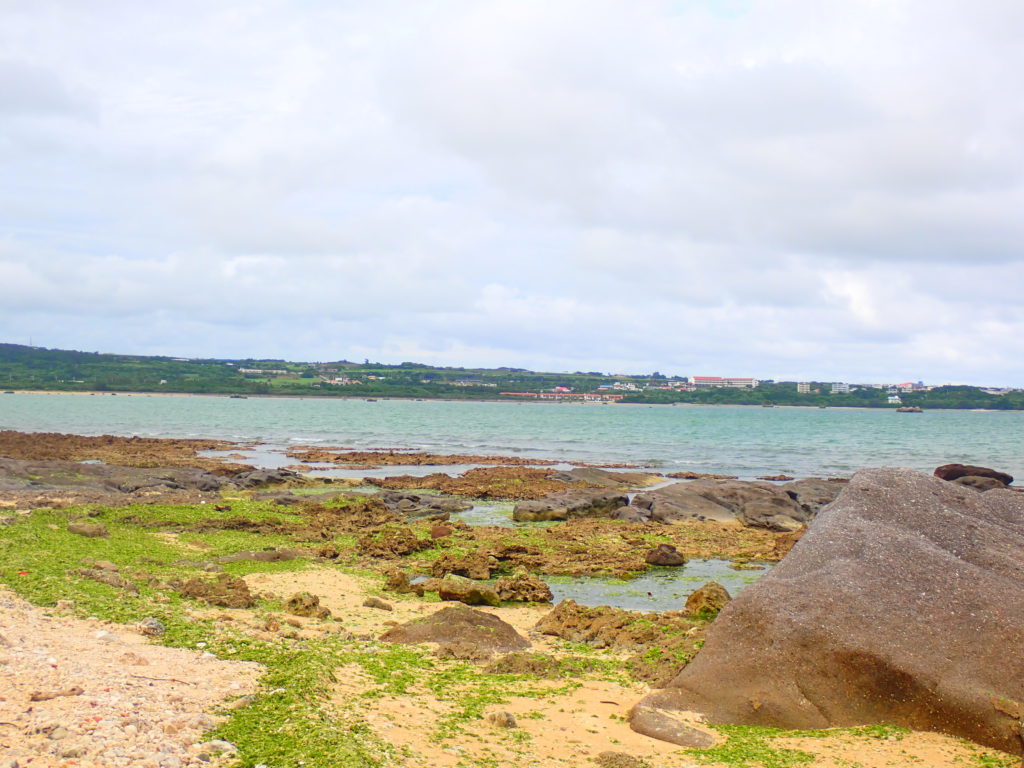
Ohama Beach is located about a 15-minute drive from the city center and the remote island terminal, and is a great spot for stargazing.
Thanks to the well-maintained seawall, you can take a stroll and, at night, admire the Southern Cross—a constellation said to be invisible from the Northern Hemisphere.
With few tourists, it's the perfect spot for those who want to take it easy.
Access: 15 minutes by car from the terminal
Parking: Available
Fulst Hara Ruins
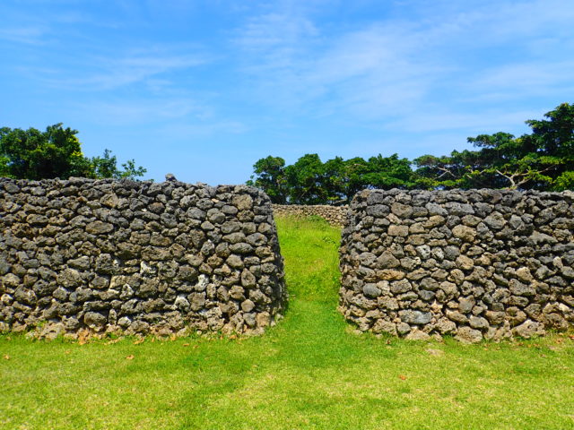
The Furusto Hara Ruins are located further inland from the Miyara River. They are also known as the “ruins of Oyake Akahachi’s castle” and are famous as the castle where Oyake Akahachi, once a heroic figure, lived.
Oyake Akahachi was a hero from Hateruma Island, famous for rebelling against the Ryukyu Kingdom.
Address: Ohama, Ishigaki City, Okinawa Prefecture
Directions: About a 15-minute drive from Ishigaki Port
Parking: Available
Maesato Dam
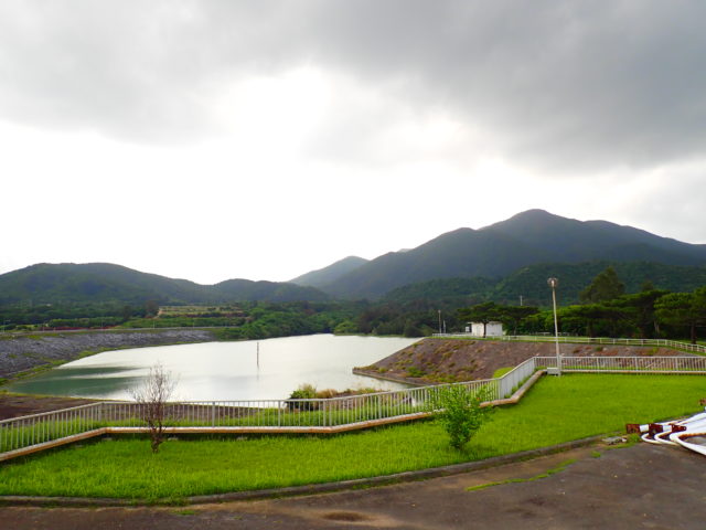
The Maezato Dam, built on the main stem of the Miyara River system, is the southernmost multipurpose dam in Japan and is used for irrigation, flood control, and water supply.
Across from the Maeri Dam is the Sokohara Dam, and both serve as lifelines for the islanders.
Location: Maesato, Ishigaki City, Okinawa Prefecture
Access: 20 minutes by car from the remote island terminal
Details of Miyara River
| Location | Ohama, Ishigaki City, Okinawa Prefecture (in Japanese history)View on Map) |
| Access | Approximately 15 minutes by car from Shin-Ishigaki Airport Approximately 15 minutes from Ishigaki Port Terminal |
| parking lot | Free parking for about 4 cars |
| toilet | nashi (Pyrus pyrifolia, esp. var. culta) |
| Business Hours | - |


")