


Ishigaki Island - Majaido -
Early reservations are recommended as they fill up quickly.

◆Tuk-tuks and electric trikes are also popular!

What Is Shin-Shiai-do?
The Urika well, located in front of Kadekaru Utaki near the Shiraho settlement—home to Shiraho Beach, which is close to the airport.
Although it was buried by the Meiwa Tsunami, it is said that an official of the Shuri Royal Court named Ma Shinsha had it unearthed again.
There is also Shiraho Coral Village nearby.
How to Get to Shinjai-ido
Mashai-ido is located about a 25-minute drive from the Remote Islands Terminal and about a 10-minute drive from New Ishigaki Island Airport.
If you're coming from the Remote Islands Terminal, exit the terminal, turn right, and head north on National Route 360 toward the airport.
Follow the road for a while, and when you see the white post office on your left, turn right at the fourth street.
After passing the first corner, you'll see the Mashi Well on your right.
If you're coming from New Ishigaki Airport, exit the airport and head south on National Route 360.
When you see the guesthouse "Taazuguya" on your right, turn left at the third street, and after passing the first corner, you'll find the Mashi Well on your right.
How to Have Fun at Shin-Shiai-ido
Until the 1950s, it served as a valuable source of drinking water in the Shiraho area.
That is why it is still carefully preserved today.
This is a spot you'll want to visit along with Shiraho Beach.
Details on Shinjaido
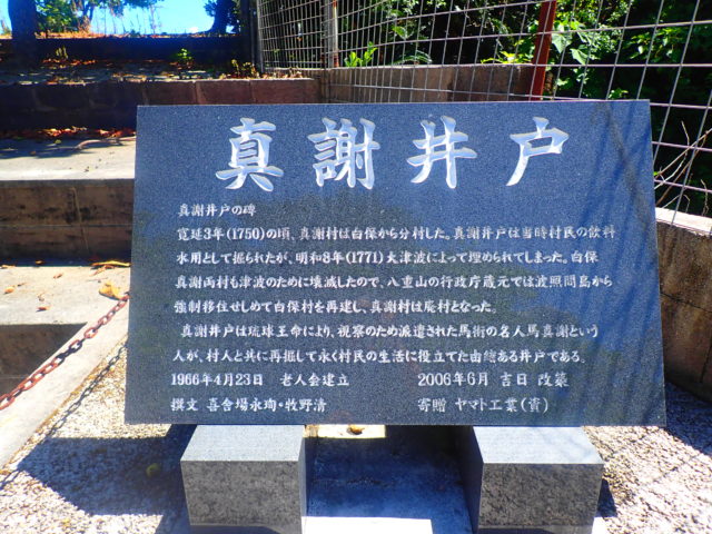
Mashai-ido is a communal well known as “Urika” (the “descending well”), which is the island’s original well; it is a historic well that has been in use since ancient times.
Although it was buried by the great tsunami of 1771, the folk song “Shindasuri-bushi” tells of its rediscovery, and the story has been passed down through the generations.
Until the water supply system was established, it played a vital role as a lifeline for providing drinking water in the Shiraho area.
In the Yaeyama Islands, including Ishigaki Island, wells have long been revered as a source of life-giving water, and prayers of gratitude are offered there.
After 30 years, work was carried out to remove the sediment that had accumulated at the bottom of the well.
In June 1997, it was designated as a cultural property of Ishigaki Island.
In addition to the Mashai Well, the following are the other Urika (descending wells) on Ishigaki Island.
・Shinkawa Area
Aramarina (Shinsei Ido)
Aramarina (New Well) is a well shaft located in the Shinkawa area, with a diameter of approximately 4 meters at the entrance.
The well is surrounded and edged by three tiers of stones.
There are eight steps leading from the ground up to partway along the latitude line.
It remains well-preserved to this day and is regarded as an important place of worship.
There is a legend associated with that Aramarina (Shinsei Ido).
About 50 meters west of Nagasaki Ontake, there is a spring. The villagers dug a well at that spot and named it “Shinsei Well.”
The water drawn from the New Well was known as “divine purification water” and was offered at Nagasaki Ontake.
When Shinkawa Village was established as a separate village from Ishigaki Village in 1757, it was named after a well.
・Hira-toku Area
Piner Car
The Piner Car is a well located in the Hira-toku area. It has a passage (excavated width) approximately 1 meter wide and 20 meters long, and a steep slope leading down to the bottom of the well, which is approximately 11 meters below ground level.
The date of the excavation is unknown.
・Ohama Area
Uninger (Une's Well)
Uninger (Une no Ido) is a 1 meter 60 centimeters-long rectangular well located in the thickets near the cliffs of the Furusubaru Ruins, accessible by heading northwest-northwest from Mizunon Utaki in the Ohama area.
This well was a precious resource that never ran dry, even during droughts, and continued to provide drinking water to the villagers.
Every year in the 10th month of the lunar calendar, the “Uninga-ni-gai” (Wishes at the Une Well) ceremony is held here.
Legend has it that Uninger (Une no Ido) discovered the well after spotting a hiyodori (Japanese white-eye) playing in the spring water.
・Miyara Area
Adaduna
Adaduna is a well located down the path leading from the Miyara settlement toward the sea.
A dense forest of banyan trees surrounds the well, making it a spot with a unique atmosphere.
Recommended Sightseeing Spots Near Shinjai-ido
Shiraho Coast
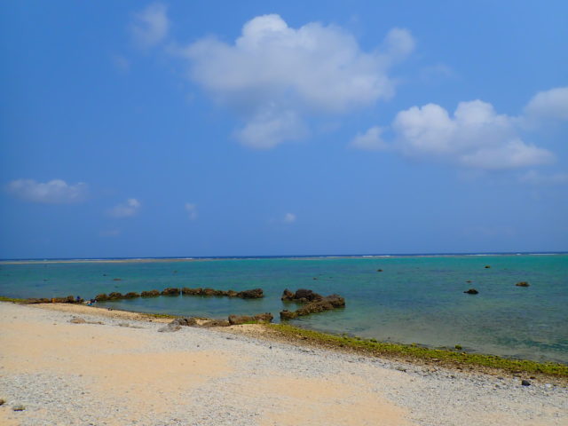
Shiraho Beach is located along the road heading toward the ocean from Mashai-ido.
It’s conveniently located about a 5-minute drive from New Ishigaki Airport, making it extremely convenient.
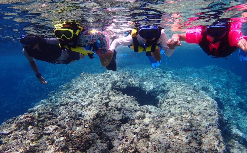
This spot offers a beautiful contrast between the crystal-clear waters—which boast the island’s greatest variety and abundance of coral and tropical fish—and the long white beach.
With over 70 species of coral—including Usukomon coral, beach coral, and Acropora—and home to popular tropical fish such as clownfish, it is a famous snorkeling spot.
There is a large colony of blue coral, a rare species, and this colony is said to be the largest in the Northern Hemisphere.
Quite a few people from both Japan and abroad visit Shiraho Beach.
Location: Shiraho, Ishigaki City, Okinawa Prefecture
Access: 5 minutes by car from Ishigaki Airport
Parking: -
Meals (nearby): None
Toilet: No
Miyara River
When heading from Miyara River to Mashai-ido, take National Route 390 from Mashai-ido and head south.
After driving for a while, you'll come to Miyara Bridge; park in the parking lot there and walk down the stairs to the Miyara River.
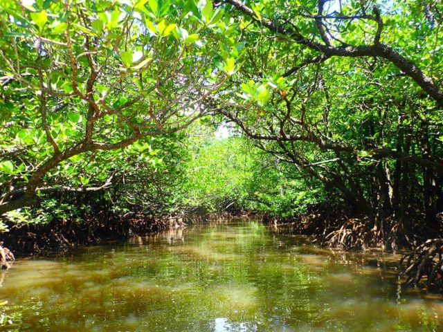
The Miyara River is the largest river on Ishigaki Island, and mangroves grow densely along both banks for 1.5 km from the mouth upstream.
Most of these mangrove plants belong to the Rhizophora genus—including Mahirugi, Ohirugi, and Mehirugi, which are designated as National Natural Monuments—and the mangrove forest covers a vast area of 225 hectares, equivalent to approximately 48 Tokyo Domes.
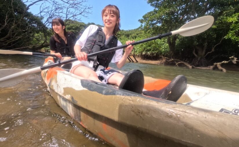
Cruises—including SUP, canoeing, and sightseeing boat tours—are offered on the Miyara River, allowing visitors to enjoy observing mangroves and wildlife while cruising.
At low tide, you can observe mangrove roots and the creatures that live in the mudflats.
Location: Ohama, Ishigaki City, Okinawa Prefecture
Access: 15 minutes by car from Shin-Ishigaki Airport, 15 minutes from Ishigaki Port Remote Island Terminal
Parking: Free parking: approx. 4 cars
Meals (nearby): None
Toilet: None
Fulst Hara Ruins
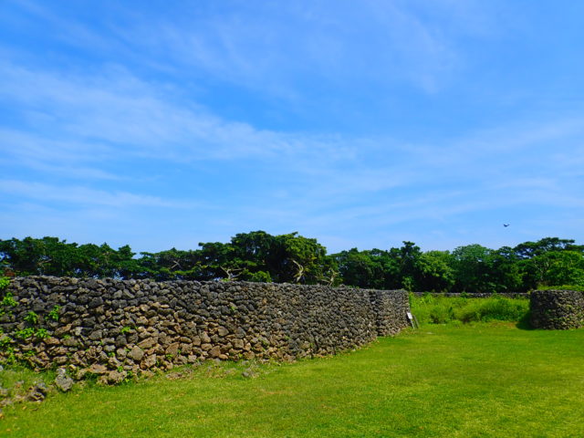
To reach the Furusto Hara Ruins, head south from the Miyara River toward the Remote Islands Terminal, then turn right at the Marukatsu Soba Restaurant.
Turn left at the end of the hall and continue straight; you'll find it on your right.
It's a bit tucked away, so it might be hard to find, but there's a sign, so just follow it.
At the end of the gravel road lies an archaeological site, which is said to be the ruins of Oyake Akahachi’s castle.
The hero Oyake Akahachi is famous as a native of Hateruma Island who rose up in rebellion to secure the independence of the Yaeyama Islands from the Ryukyu Kingdom, which had been imposing heavy taxes.
Address: Ohama, Ishigaki City, Okinawa Prefecture
Directions: About a 15-minute drive from Ishigaki Port
Phone number: 0980-82-1535 (Ishigaki City Hall Tourism and Culture Division)
Hours of operation: None
Parking: Available
Restaurant: None
Toilet: None
Rest Area: None
Parking: None
Details on Shinjaido
| Location | Shiraho, Ishigaki City, Okinawa Prefecture (View in MAP) |
| Access | About a 25-minute drive from the Remote Islands Terminal |
| parking lot | nashi (Pyrus pyrifolia, esp. var. culta) |
| toilet | nashi (Pyrus pyrifolia, esp. var. culta) |
| Business Hours | - |
See all activities
Ishigaki Island Tours
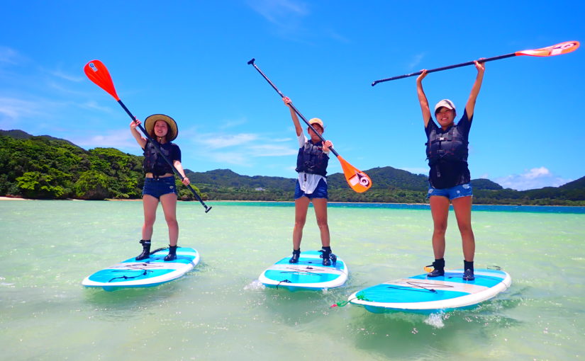





















































![[Ishigaki Island / Approx. 2.5 hours] Same-day reservations accepted! SUP tour to the mystical “Blue Cave”★ A new experience in crystal-clear waters♪ Free photos](https://ishigaki-tours.com/wp-content/uploads/2017/12/DB89F99F-C338-4E76-BC19-CEC4FDDE95AC-1-825x510.jpeg)